ZCZC MIATWOAT ALL
TTAA00 KNHC DDHHMM
Tropical Weather Outlook
NWS National Hurricane Center Miami FL
700 PM EST Thu Nov 23 2023
For the North Atlantic...Caribbean Sea and the Gulf of Mexico:
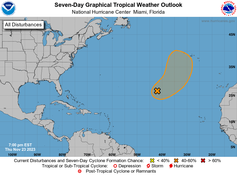
1. Central Subtropical Atlantic (AL90):
A non-tropical area of low pressure located in the central
subtropical Atlantic is producing winds up to gale-force while
associated with disorganized shower and thunderstorm activity. This
system could become a subtropical or tropical storm over the next
few days as it gradually loses its frontal characteristics while
it moves northeastward. By early next week, its chances of
subtropical or tropical development should end as the system moves
over cooler waters. For more information on this system, including
gale warnings, please see High Seas Forecasts issued by the
National Weather Service.
* Formation chance through 48 hours...low...30 percent.
* Formation chance through 7 days...medium...40 percent.
High Seas Forecasts issued by the National Weather Service
can be found under AWIPS header NFDHSFAT1, WMO header FZNT01
KWBC, and online at ocean.weather.gov/shtml/NFDHSFAT1.php
Forecaster Papin