ZCZC MIATWOAT ALL
TTAA00 KNHC DDHHMM
Tropical Weather Outlook
NWS National Hurricane Center Miami FL
100 AM EST Mon Nov 20 2023
For the North Atlantic...Caribbean Sea and the Gulf of Mexico:
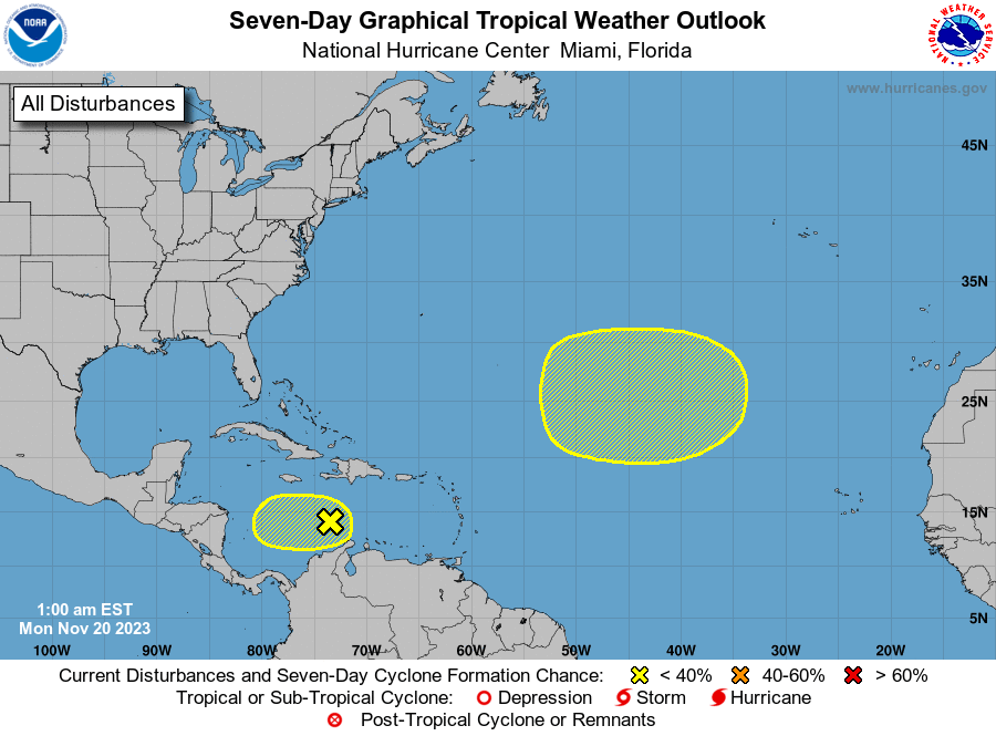
1. Central Caribbean Sea:
A small, weak area of low pressure located over the central
Caribbean Sea is producing limited shower and thunderstorm activity.
Dry air in the surrounding environment is likely to prevent
significant development of this system while it drifts slowly
westward during the next few days.
* Formation chance through 48 hours...low...10 percent.
* Formation chance through 7 days...low...10 percent.
2. Central Subtropical Atlantic:
A non-tropical area of low pressure is forecast to develop along a
front over the central portion of the Atlantic basin during the next
couple of days. This system could separate from the front and
gradually acquire some tropical or subtropical characteristics
during the latter part of this week while it moves generally
eastward across the central subtropical Atlantic.
* Formation chance through 48 hours...low...near 0 percent.
* Formation chance through 7 days...low...20 percent.
Forecaster Reinhart