ZCZC MIATWOAT ALL
TTAA00 KNHC DDHHMM
Tropical Weather Outlook
NWS National Hurricane Center Miami FL
100 PM EST Tue Nov 14 2023
For the North Atlantic...Caribbean Sea and the Gulf of Mexico:
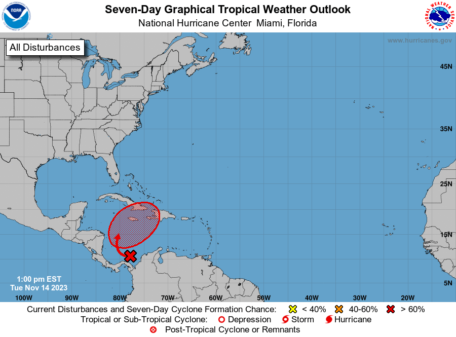
1. Southwestern Caribbean Sea:
A large area of disorganized showers and thunderstorms over the
southwestern Caribbean Sea is associated with a broad trough of low
pressure. Environmental conditions appear conducive for
development of this system, and a tropical depression is likely to
form during the latter part of the week while moving northeastward
across the western and central portions of the Caribbean Sea.
Interests in Jamaica, Cuba, Haiti, the Dominican Republic, the
southeastern Bahamas, and the Turks and Caicos Islands should
monitor the progress of this system. Regardless of development,
this system has the potential to produce heavy rains over portions
of the Caribbean coast of Central America and the Greater Antilles
through the end of this week.
* Formation chance through 48 hours...low...20 percent.
* Formation chance through 7 days...high...70 percent.
Forecaster Berg