ZCZC MIATWOAT ALL
TTAA00 KNHC DDHHMM
Tropical Weather Outlook
NWS National Hurricane Center Miami FL
800 AM EDT Sat Nov 4 2023
For the North Atlantic...Caribbean Sea and the Gulf of Mexico:
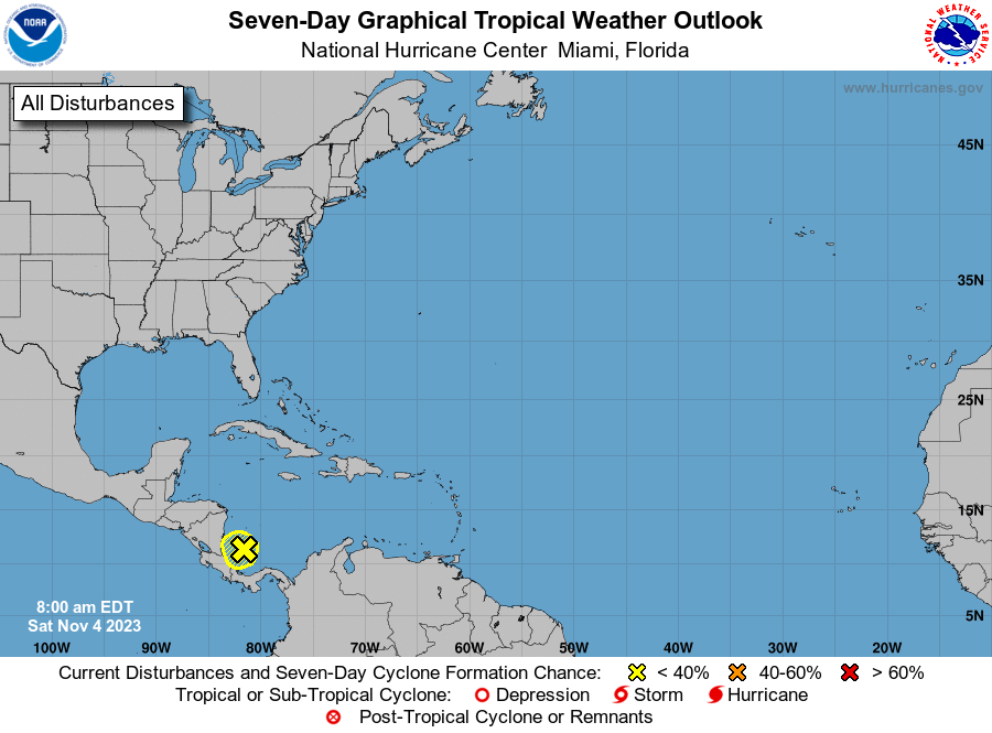
1. Western Caribbean Sea (AL97):
Surface observations and overnight satellite-derived wind data
indicate that the area of low pressure that we have been monitoring
during the past few days over the western Caribbean has reformed
about 100 miles east of the Nicaragua/Costa Rica border. Showers
and thunderstorms have increased associated with the low pressure
system, and surface pressures have fallen during the past several
hours. Some gradual development of this system is possible before
it moves inland over Central America tonight or Sunday. Regardless
of development, this system is expected to bring heavy rains to
portions of Central America this weekend. This rainfall could
produce flash flooding, along with mudslides in higher terrain
areas. For additional information about this system, see forecast
products issued by your national meteorological service.
* Formation chance through 48 hours...low...20 percent.
* Formation chance through 7 days...low...20 percent.
Forecaster Roberts