ZCZC MIATWOAT ALL
TTAA00 KNHC DDHHMM
Tropical Weather Outlook
NWS National Hurricane Center Miami FL
200 AM EDT Thu Nov 2 2023
For the North Atlantic...Caribbean Sea and the Gulf of Mexico:
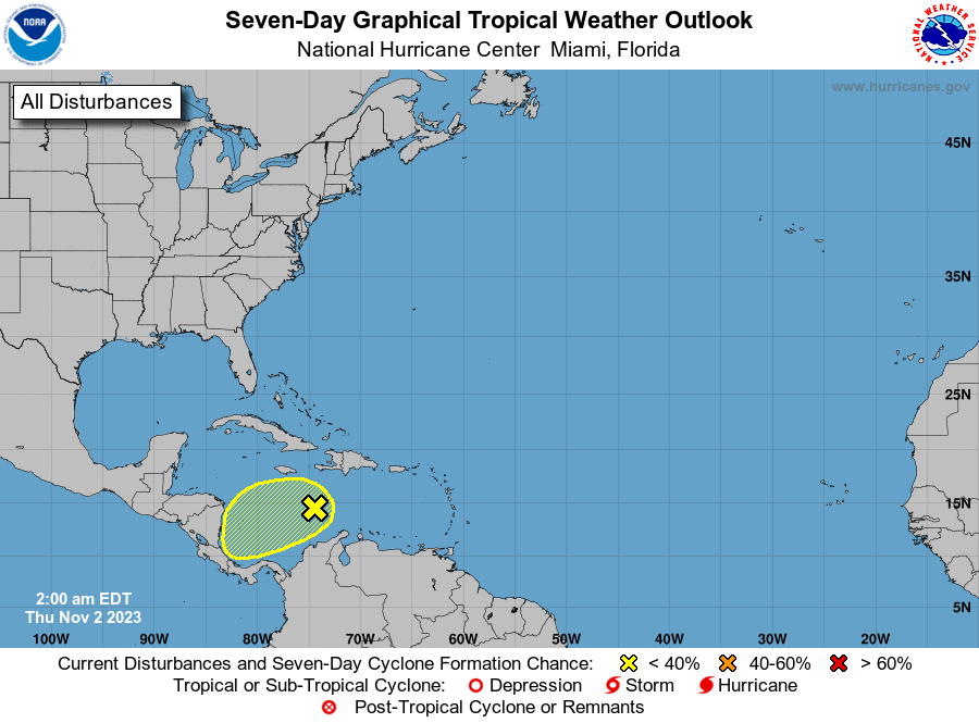
1. Central Caribbean Sea (AL97):
A trough of low pressure is producing limited shower and
thunderstorm activity while moving westward over the central
Caribbean Sea. Environmental conditions could become a little more
conducive for some development of this disturbance over the next
couple of days before it moves inland over Central America by this
weekend. Regardless of development, this system has the potential to
produce heavy rains over portions of Central America late this week
and into the weekend.
* Formation chance through 48 hours...low...20 percent.
* Formation chance through 7 days...low...30 percent.
Forecaster Reinhart