ZCZC MIATWOAT ALL
TTAA00 KNHC DDHHMM
Tropical Weather Outlook
NWS National Hurricane Center Miami FL
800 AM EDT Wed Nov 1 2023
For the North Atlantic...Caribbean Sea and the Gulf of Mexico:
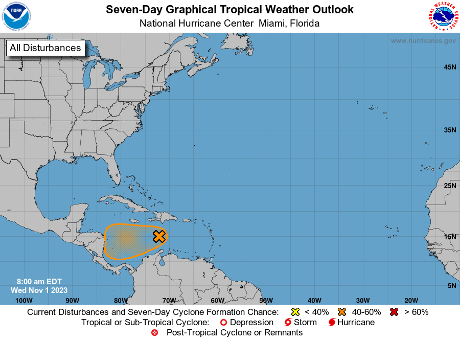
1. Central Caribbean Sea (AL97):
Disorganized showers and thunderstorms over the central Caribbean
Sea are associated with a trough of low pressure. Environmental
conditions could become a little more conducive for development in a
day or two, and a tropical depression could form when the system
moves over the southwestern Caribbean Sea during the latter part of
this week. Regardless of development, this system has the potential
to produce heavy rains over portions of Central America late this
week and into the weekend.
* Formation chance through 48 hours...low...20 percent.
* Formation chance through 7 days...medium...50 percent.
Forecaster Brown