ZCZC MIATWOAT ALL
TTAA00 KNHC DDHHMM
Tropical Weather Outlook
NWS National Hurricane Center Miami FL
800 AM EDT Tue Oct 31 2023
For the North Atlantic...Caribbean Sea and the Gulf of Mexico:
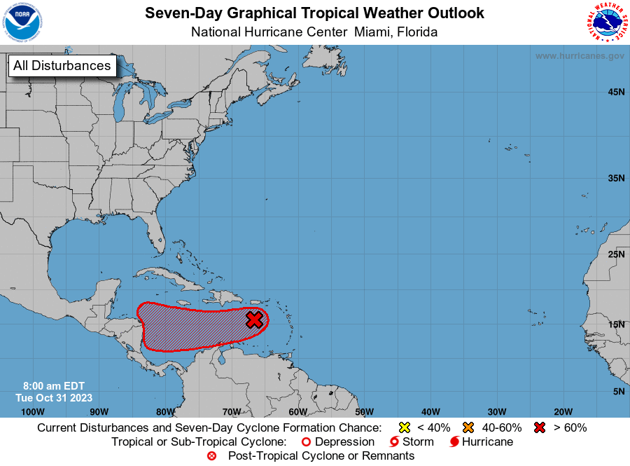
1. Eastern Caribbean Sea (AL97):
A trough of low pressure over the eastern Caribbean Sea is producing
a large area of showers and thunderstorms. Environmental conditions
appear conducive for further development during the next several
days while the system moves westward over the central and
southwestern Caribbean Sea, and a tropical depression is likely to
form by the latter part of this week. Regardless of development,
this system has the potential to produce heavy rains over portions
of Central America towards the end of the week.
* Formation chance through 48 hours...low...30 percent.
* Formation chance through 7 days...high...70 percent.
Forecaster Kelly