ZCZC MIATWOAT ALL
TTAA00 KNHC DDHHMM
Tropical Weather Outlook
NWS National Hurricane Center Miami FL
200 AM EDT Sun Oct 29 2023
For the North Atlantic...Caribbean Sea and the Gulf of Mexico:
Active Systems:
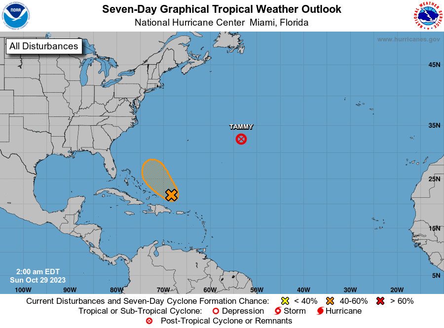
The National Hurricane Center is issuing advisories on Tropical
Storm Tammy, located several hundred miles east of Bermuda.
1. Southwestern Atlantic Ocean (AL96):
Shower and thunderstorm activity is showing signs of organization
in association with an area of low pressure located a couple of
hundred miles north of the Dominican Republic. A short-lived
tropical depression or storm could form later today while the
system moves west-northwestward. By Monday, however, strong
upper-level winds and dry air should end the chances of further
development. An Air Force reconnaissance aircraft is scheduled to
investigate the system later today, if necessary.
* Formation chance through 48 hours...medium...50 percent.
* Formation chance through 7 days...medium...50 percent.
Forecaster Cangialosi