ZCZC MIATWOAT ALL
TTAA00 KNHC DDHHMM
Tropical Weather Outlook
NWS National Hurricane Center Miami FL
800 PM EDT Sat Oct 28 2023
For the North Atlantic...Caribbean Sea and the Gulf of Mexico:
Active Systems:
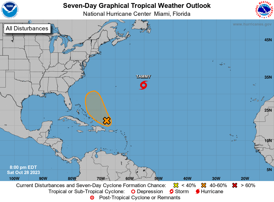
The National Hurricane Center is issuing advisories on Tropical
Storm Tammy, located several hundred miles east of Bermuda.
1. Southwestern Atlantic Ocean (AL96):
Shower and thunderstorm activity has increased with a small area of
low pressure located about 200 miles northeast of the coast of the
Dominican Republic. While upper-level winds are only marginally
conducive for further development, this system could become a
short-lived tropical depression or storm over the next day or so. By
Monday, upper-level winds are forecast to become too strong for
further development as the system turns northward to the east of the
northwestern Bahamas.
* Formation chance through 48 hours...medium...50 percent.
* Formation chance through 7 days...medium...50 percent.
Forecaster Papin