ZCZC MIATWOAT ALL
TTAA00 KNHC DDHHMM
Tropical Weather Outlook
NWS National Hurricane Center Miami FL
200 AM EDT Mon Oct 23 2023
For the North Atlantic...Caribbean Sea and the Gulf of Mexico:
Active Systems:
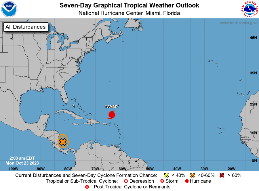
The National Hurricane Center is issuing advisories on Hurricane
Tammy, located a few hundred miles north of the northern Leeward
Islands.
1. Southwestern Caribbean Sea (AL95):
Showers and thunderstorms continue to show signs of organization in
association with a low pressure system located over the southwestern
Caribbean Sea. Environmental conditions appear to be favorable for
development, and a short-lived tropical depression could form before
the system moves inland over Nicaragua by early Tuesday. Regardless
of development, this system could produce heavy rains over portions
of Central America during the next couple of days.
* Formation chance through 48 hours...medium...60 percent.
* Formation chance through 7 days...medium...60 percent.
Forecaster Papin