ZCZC MIATWOAT ALL
TTAA00 KNHC DDHHMM
Tropical Weather Outlook
NWS National Hurricane Center Miami FL
800 AM EDT Sun Oct 22 2023
For the North Atlantic...Caribbean Sea and the Gulf of Mexico:
Active Systems:
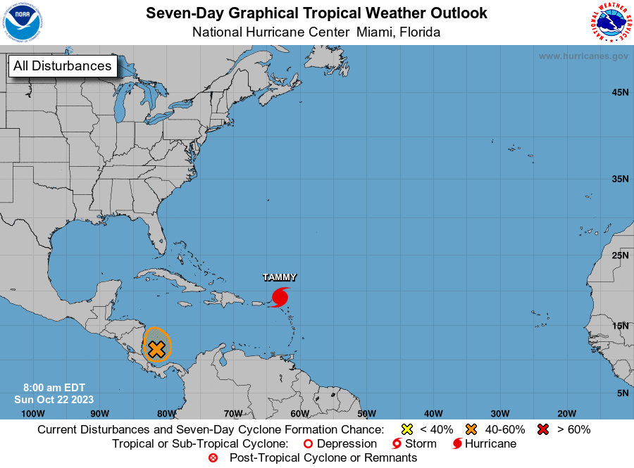
The National Hurricane Center is issuing advisories on Hurricane
Tammy, located just north of the northern Leeward Islands.
1. Southwestern Caribbean Sea (AL95):
Showers and thunderstorms have become better organized in
association with a low pressure system located over the southwestern
Caribbean Sea. Gradual development of this system is possible, and
a tropical depression could form before the system moves inland over
Nicaragua by early Tuesday. Regardless of development, this system
could produce heavy rains over portions of Central America during
the next couple of days.
* Formation chance through 48 hours...medium...50 percent.
* Formation chance through 7 days...medium...50 percent.
Forecaster Cangialosi