ZCZC MIATWOAT ALL
TTAA00 KNHC DDHHMM
Tropical Weather Outlook
NWS National Hurricane Center Miami FL
200 AM EDT Tue Oct 17 2023
For the North Atlantic...Caribbean Sea and the Gulf of Mexico:
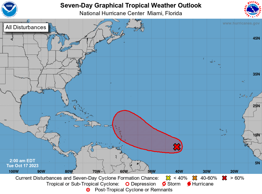
1. Central Tropical Atlantic (AL94):
A broad area of low pressure located over the central tropical
Atlantic, about midway between the Windward Islands and the Cabo
Verde Islands, is producing a large area of disorganized showers
and thunderstorms. Environmental conditions are expected to
remain conducive for gradual development, and a tropical depression
will likely form during the next few days while the system moves
westward to west-northwestward across the central and western
tropical Atlantic. Interests in the Lesser Antilles should monitor
the progress of this system.
* Formation chance through 48 hours...medium...50 percent.
* Formation chance through 7 days...high...80 percent.
Forecaster Cangialosi