ZCZC MIATWOAT ALL
TTAA00 KNHC DDHHMM
Tropical Weather Outlook
NWS National Hurricane Center Miami FL
800 PM EDT Mon Oct 16 2023
For the North Atlantic...Caribbean Sea and the Gulf of Mexico:
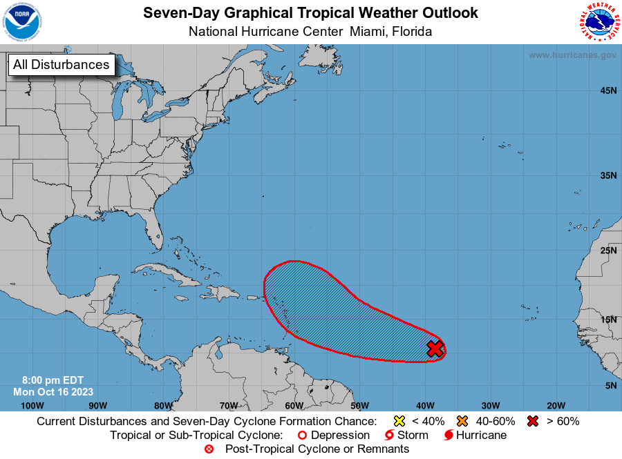
1. Central Tropical Atlantic (AL94):
A broad area of low pressure located over the central tropical
Atlantic, about midway between the Windward Islands and the
west coast of Africa, is producing a large area of disorganized
showers and thunderstorms. Environmental conditions are expected
to remain conducive for further development, and a tropical
depression will likely form during the next few days. This system
is forecast to move westward to west-northwestward across the
central and western tropical Atlantic during the next several days.
* Formation chance through 48 hours...medium...40 percent.
* Formation chance through 7 days...high...80 percent.
Forecaster Roberts