ZCZC MIATWOAT ALL
TTAA00 KNHC DDHHMM
Tropical Weather Outlook
NWS National Hurricane Center Miami FL
200 AM EDT Mon Oct 16 2023
For the North Atlantic...Caribbean Sea and the Gulf of Mexico:
Active Systems:
The National Hurricane Center has issued the last advisory on
Post-Tropical Cyclone Sean, located over the central tropical
Atlantic.
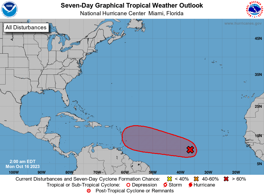
1. Central Tropical Atlantic (AL94):
A broad area of low pressure located over the central tropical
Atlantic is producing disorganized shower activity. Although the
environment may not support much development during the next couple
of days, conditions are expected to become more conducive
thereafter, and a tropical depression is still likely to form by
late this week. This system is expected to move westward or
west-northwestward across the central and western tropical Atlantic
during the next several days.
* Formation chance through 48 hours...low...20 percent.
* Formation chance through 7 days...high...70 percent.
Forecaster Cangialosi