ZCZC MIATWOAT ALL
TTAA00 KNHC DDHHMM
Tropical Weather Outlook
NWS National Hurricane Center Miami FL
800 AM EDT Fri Oct 13 2023
For the North Atlantic...Caribbean Sea and the Gulf of Mexico:
Active Systems:
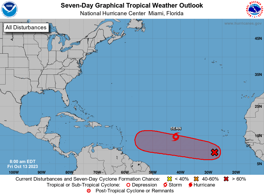
The National Hurricane Center is issuing advisories on Tropical
Storm Sean, located over the central tropical Atlantic.
1. Eastern Tropical Atlantic (AL94):
A broad area of low pressure located several hundred miles
south-southwest of the Cabo Verde Islands continues to produce a few
disorganized showers and thunderstorms. Only gradual development of
this disturbance is expected during the next couple of days.
Environmental conditions are expected to become more conducive for
development by the end of the weekend while the disturbance begins
to move westward across the central tropical Atlantic. Additional
development is expected after that, and a tropical depression is
likely to form during the early to middle portion of next week as
the system moves steadily westward across the central and western
tropical Atlantic.
* Formation chance through 48 hours...low...10 percent.
* Formation chance through 7 days...high...70 percent.
Forecaster D. Zelinsky