ZCZC MIATWOAT ALL
TTAA00 KNHC DDHHMM
Tropical Weather Outlook
NWS National Hurricane Center Miami FL
200 PM EDT Thu Oct 12 2023
For the North Atlantic...Caribbean Sea and the Gulf of Mexico:
Active Systems:
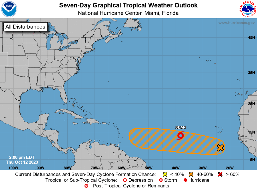
The National Hurricane Center is issuing advisories on recently
upgraded Tropical Storm Sean, located over the central tropical
Atlantic.
1. Eastern Tropical Atlantic (AL94):
Shower and thunderstorm activity is limited and disorganized this
afternoon in association with a broad area of low pressure located
several hundred miles to the south of the Cabo Verde Islands. While
environmental conditions are currently only marginally favorable for
slow development over the next couple of days, they are forecast to
become more favorable by early next week. A tropical depression
could form by the middle of next week as this system moves generally
westward across the eastern and central tropical Atlantic.
* Formation chance through 48 hours...low...10 percent.
* Formation chance through 7 days...medium...40 percent.
Forecaster Papin