ZCZC MIATWOAT ALL
TTAA00 KNHC DDHHMM
Tropical Weather Outlook
NWS National Hurricane Center Miami FL
800 PM EDT Wed Oct 11 2023
For the North Atlantic...Caribbean Sea and the Gulf of Mexico:
Active Systems:
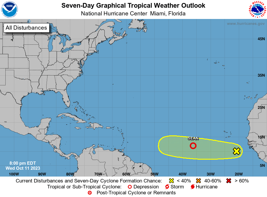
The National Hurricane Center is issuing advisories on Tropical
Storm Sean, located over the eastern tropical Atlantic.
1. Eastern Tropical Atlantic (AL94):
A broad area of low pressure located several hundred miles to the
south-southeast of the Cabo Verde Islands is producing a large area
of disorganized showers and thunderstorms. Environmental conditions
appear conducive for some slow development over the next few days.
This system should move generally westward across the eastern and
central tropical Atlantic through early next week.
* Formation chance through 48 hours...low...20 percent.
* Formation chance through 7 days...low...30 percent.
Public Advisories on Tropical Storm Sean are issued under WMO header
WTNT34 KNHC and under AWIPS header MIATCPAT4. Forecast/Advisories on
Tropical Storm Sean are issued under WMO header WTNT24 KNHC and
under AWIPS header MIATCMAT4.
Forecaster Bucci