Skip Navigation Links
NOAA NOAA United States Department of Commerce

NHC Graphical Outlook Archive


« Earliest Available         ‹ Earlier         Later ›         Latest Available »
GIS Shapefiles
Central Pacific Eastern Pacific Atlantic

View 2-Day Graphical Tropical Weather Outlook
Click for Eastern Pacific Click for Eastern Pacific

Tropical Weather Outlook Text

ZCZC MIATWOAT ALL
TTAA00 KNHC DDHHMM

Tropical Weather Outlook
NWS National Hurricane Center Miami FL
200 PM EDT Sun Oct 8 2023

For the North Atlantic...Caribbean Sea and the Gulf of Mexico:

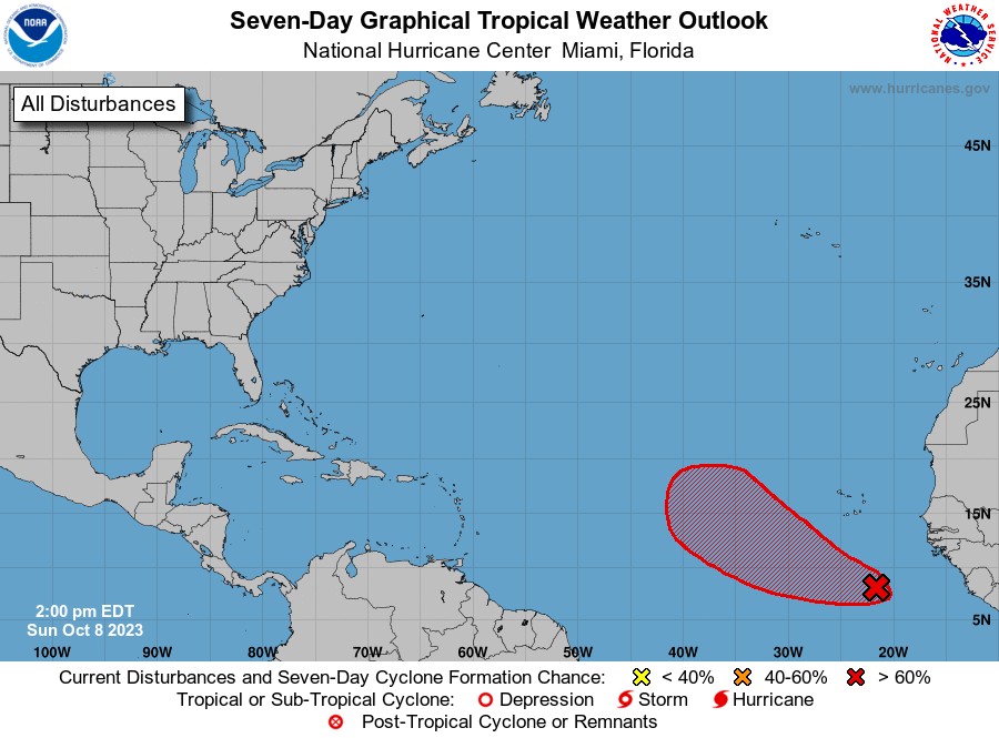
1. Eastern Tropical Atlantic (AL92):
Showers and thunderstorms are beginning to show signs of 
organization in association with a low-latitude tropical wave 
located several hundred miles to the south of the Cabo Verde 
Islands. Environmental conditions appear conducive for gradual 
development of this system, and a tropical depression is likely to 
form by midweek while it moves westward to west-northwestward across 
the eastern tropical Atlantic.
* Formation chance through 48 hours...medium...40 percent.
* Formation chance through 7 days...high...80 percent.

Forecaster Papin


List of Atlantic Outlooks (May 2023 - Present)
List of East Pacific Outlooks (May 2023 - Present)
List of Central Pacific Outlooks (May 2023 - Present)
List of Atlantic Outlooks (July 2014 - April 2023)
List of East Pacific Outlooks (July 2014 - April 2023)
List of Central Pacific Outlooks (June 2019 - April 2023)
List of Atlantic Outlooks (June 2009 - June 2014)
List of East Pacific Outlooks (June 2009 - June 2014)