ZCZC MIATWOAT ALL
TTAA00 KNHC DDHHMM
Tropical Weather Outlook
NWS National Hurricane Center Miami FL
200 AM EDT Wed Sep 27 2023
For the North Atlantic...Caribbean Sea and the Gulf of Mexico:
Active Systems:
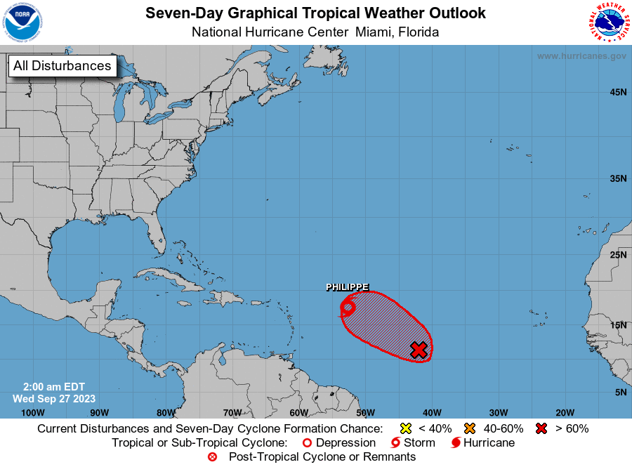
The National Hurricane Center is issuing advisories on Tropical
Storm Philippe, located over the central tropical Atlantic.
1. Central Tropical Atlantic (AL91):
Showers and thunderstorms continue to show signs of organization
in association with an area of low pressure located roughly halfway
between the Cabo Verde Islands and the Lesser Antilles.
Environmental conditions are forecast to be conducive for
development, and a tropical depression or storm is expected to form
in the next day or so while the system moves west-northwestward
across the central tropical Atlantic. Additional information on this
system, including gale warnings, can be found in High Seas Forecasts
issued by the National Weather Service.
* Formation chance through 48 hours...high...90 percent.
* Formation chance through 7 days...high...90 percent.
High Seas Forecasts issued by the National Weather Service
can be found under AWIPS header NFDHSFAT1, WMO header FZNT01
KWBC, and online at ocean.weather.gov/shtml/NFDHSFAT1.php
Forecaster Pasch