ZCZC MIATWOAT ALL
TTAA00 KNHC DDHHMM
Tropical Weather Outlook
NWS National Hurricane Center Miami FL
200 AM EDT Sun Sep 24 2023
For the North Atlantic...Caribbean Sea and the Gulf of Mexico:
Active Systems:
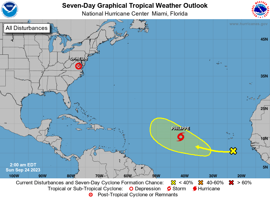
The National Hurricane Center is issuing advisories on Tropical
Storm Philippe, located over the Central Tropical Atlantic.
1. Eastern Tropical Atlantic:
A tropical wave located near the Cabo Verde Islands is producing a
broad area of disorganized showers and thunderstorms. Environmental
conditions are expected to be conducive for some gradual development
of this system during the middle to latter portions of the week
while it moves westward across the eastern and central tropical
Atlantic.
* Formation chance through 48 hours...low...near 0 percent.
* Formation chance through 7 days...low...20 percent.
Public Advisories on Philippe are issued under WMO header WTNT32
KNHC and under AWIPS header MIATCPAT2.
Forecast/Advisories on Philippe are issued under WMO header WTNT22
KNHC and under AWIPS header MIATCMAT2.
Forecaster Kelly