ZCZC MIATWOAT ALL
TTAA00 KNHC DDHHMM
Tropical Weather Outlook
NWS National Hurricane Center Miami FL
200 PM EDT Fri Sep 22 2023
For the North Atlantic...Caribbean Sea and the Gulf of Mexico:
Active Systems:
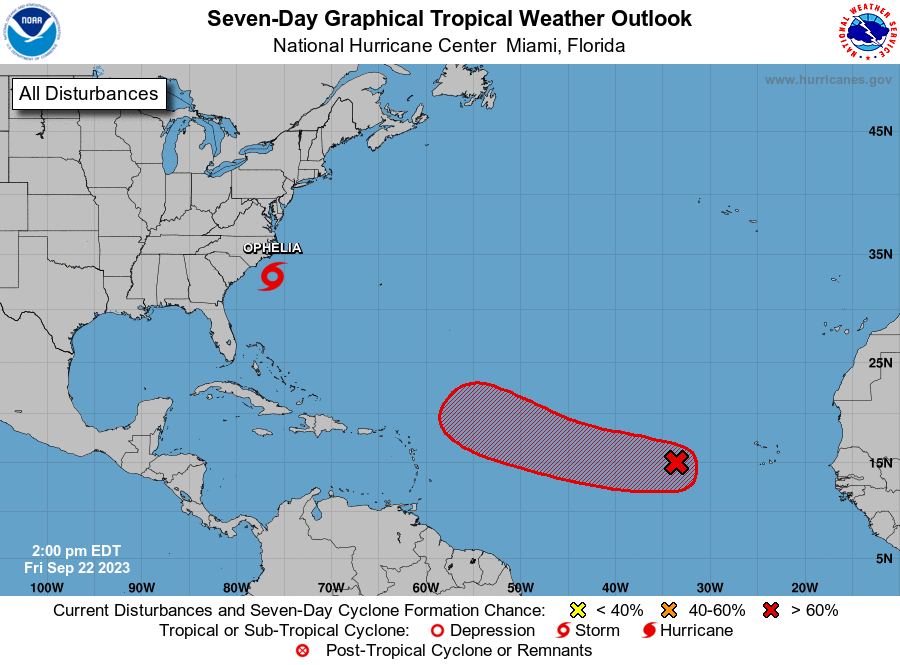
The National Hurricane Center is issuing advisories Tropical Storm
Ophelia, located a couple hundred miles south of Cape Hatteras,
North Carolina.
1. Central Tropical Atlantic (AL90):
Shower and thunderstorm activity associated with an area of low
pressure located several hundred miles west of the Cabo Verde
Islands has decreased slightly over the last few hours, however,
further development is still expected. A tropical depression is
likely to form during the next couple of days while the system moves
generally westward at 10 to 15 mph. The system is then expected to
turn west-northwestward early next week as it moves over the central
tropical Atlantic.
* Formation chance through 48 hours...high...70 percent.
* Formation chance through 7 days...high...90 percent.
Forecaster D. Zelinsky/R. Zelinsky