ZCZC MIATWOAT ALL
TTAA00 KNHC DDHHMM
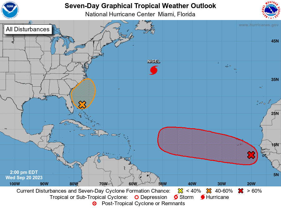
Tropical Weather Outlook
NWS National Hurricane Center Miami FL
200 PM EDT Wed Sep 20 2023
For the North Atlantic...Caribbean Sea and the Gulf of Mexico:
Active Systems:
The National Hurricane Center is issuing advisories on Hurricane
Nigel, located over the central subtropical Atlantic.
1. Eastern Tropical Atlantic:
A tropical wave is currently located a couple of hundred miles
southeast of the Cabo Verde Islands. This system is expected
to merge with another disturbance located a few hundred miles to its
west in a few days. Environmental conditions are forecast to
be conducive for gradual development, and a tropical depression is
likely to form late this week or this weekend while the system moves
generally westward at 10 to 15 mph across the eastern and central
tropical Atlantic.
* Formation chance through 48 hours...low...10 percent.
* Formation chance through 7 days...high...70 percent.
2. Western Atlantic:
A non-tropical low pressure system is expected to form within a
large area of disorganized showers and thunderstorms to the east
of the Florida peninsula within the next day or two. This system
could acquire some subtropical characteristics on Friday while it
moves generally northward. Regardless of development, this low is
likely to bring gusty winds to gale force, heavy rain, and high surf
to portions of the Southeast and Mid-Atlantic United States late
this week and into this weekend. Additional information on this
system can be found in High Seas Forecasts and products from your
local National Weather Service office.
* Formation chance through 48 hours...low...10 percent.
* Formation chance through 7 days...medium...40 percent.
High Seas Forecasts issued by the National Weather Service
can be found under AWIPS header NFDHSFAT1, WMO header FZNT01
KWBC, and online at ocean.weather.gov/shtml/NFDHSFAT1.php
Forecaster Pasch