ZCZC MIATWOAT ALL
TTAA00 KNHC DDHHMM
Tropical Weather Outlook
NWS National Hurricane Center Miami FL
Issued by the NWS Weather Prediction Center College Park MD
200 PM EDT Thu Sep 14 2023
For the North Atlantic...Caribbean Sea and the Gulf of Mexico:
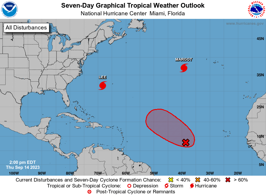
Active Systems:
The National Hurricane Center is issuing advisories on Hurricane
Lee, located a couple of hundred miles west-southwest of Bermuda,
and on Hurricane Margot, located several hundred miles
west-southwest of the Azores.
1. Central Tropical Atlantic (AL97):
Showers and thunderstorms show some organization in association
with a broad low pressure area located about midway between the
Lesser Antilles and the Cabo Verde Islands. Environmental
conditions are expected to be conducive for additional development,
and this system is very likely to become a tropical depression
during the next day or so while it moves west-northwestward to
northwestward at 10 to 15 mph across the central tropical Atlantic.
* Formation chance through 48 hours...high...90 percent.
* Formation chance through 7 days...high...90 percent.
Forecaster Roth/Blake