ZCZC MIATWOAT ALL
TTAA00 KNHC DDHHMM
Tropical Weather Outlook
NWS National Hurricane Center Miami FL
800 AM EDT Thu Sep 14 2023
For the North Atlantic...Caribbean Sea and the Gulf of Mexico:
Active Systems:
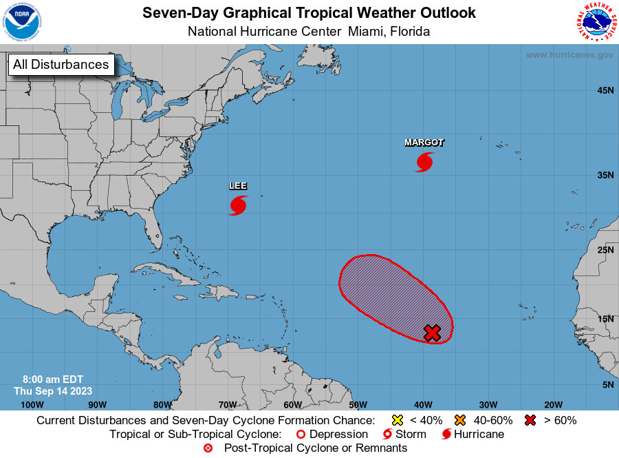
The National Hurricane Center is issuing advisories on Hurricane
Lee, located a few hundred miles southwest of Bermuda, and on
Hurricane Margot, located over the central Atlantic.
1. Central Tropical Atlantic (AL97):
Showers and thunderstorms associated with a broad low pressure area
located about 1000 miles west-southwest of the Cabo Verde Islands
have increased and become a little better organized since yesterday.
Environmental conditions are expected to be conducive for additional
development, and this system is likely to become a tropical
depression during the day or so while it moves west-northwestward to
northwestward at 10 to 15 mph across the central tropical Atlantic.
* Formation chance through 48 hours...high...90 percent.
* Formation chance through 7 days...high...90 percent.
Forecaster Brown