ZCZC MIATWOAT ALL
TTAA00 KNHC DDHHMM
Tropical Weather Outlook
NWS National Hurricane Center Miami FL
Issued by the NWS Weather Prediction Center College Park MD
200 PM EDT Wed Sep 13 2023
For the North Atlantic...Caribbean Sea and the Gulf of Mexico:
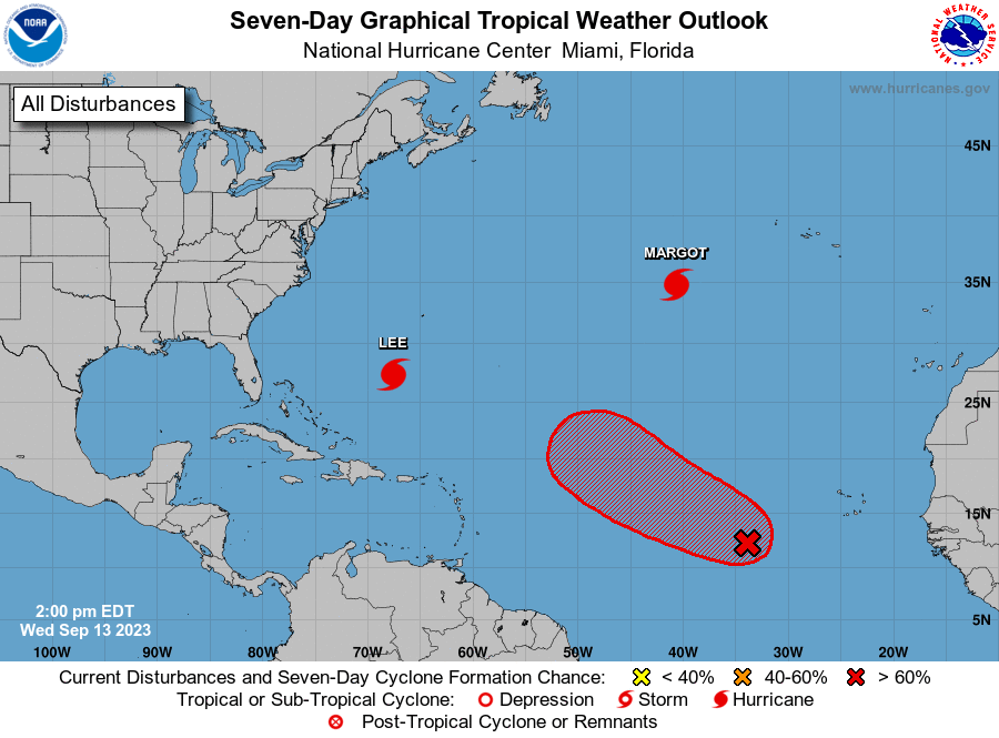
Active Systems:
The National Hurricane Center is issuing advisories on Hurricane
Lee, located several hundred miles south-southwest of Bermuda, and
on Hurricane Margot, located over the central subtropical Atlantic.
1. Central Tropical Atlantic (AL97):
Showers and thunderstorms associated with a broad area of low
pressure located several hundred miles west-southwest of the Cabo
Verde Islands are showing some signs of organzation. This
system's low-level circulation is gradually becoming better
defined, and a tropical depression is likely to form by this weekend
as the low moves west-northwestward to northwestward at 10 to 15
mph across the central tropical Atlantic.
* Formation chance through 48 hours...high...70 percent.
* Formation chance through 7 days...high...90 percent.
Forecaster Orrison/Blake