ZCZC MIATWOAT ALL
TTAA00 KNHC DDHHMM
Tropical Weather Outlook
NWS National Hurricane Center Miami FL
Issued by the NWS Weather Prediction Center College Park MD
200 PM EDT Tue Sep 12 2023
For the North Atlantic...Caribbean Sea and the Gulf of Mexico:
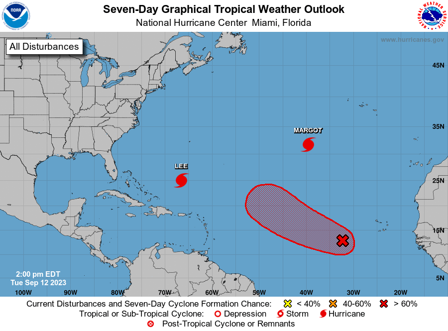
Active Systems:
The National Hurricane Center is issuing advisories on Hurricane
Lee, located several hundred miles south of Bermuda, and on
Hurricane Margot, located over the central subtropical Atlantic.
1. Eastern and Central Tropical Atlantic (AL97 and AL98):
A broad area of low pressure over the eastern tropical Atlantic
continues to produce disorganized showers and thunderstorms. This
system is expected to consolidate, with a low on the western side
becoming dominant over the next day or two. Gradual development of
the low is expected after that, and a tropical depression is likely
to form by this weekend while the system moves west-northwestward
or northwestward at about 15 mph across the central tropical
Atlantic.
* Formation chance through 48 hours...low...20 percent.
* Formation chance through 7 days...high...80 percent.
Forecaster Blake/Gallina/Bann