ZCZC MIATWOAT ALL
TTAA00 KNHC DDHHMM
Tropical Weather Outlook
NWS National Hurricane Center Miami FL
200 AM EDT Tue Sep 12 2023
For the North Atlantic...Caribbean Sea and the Gulf of Mexico:
Active Systems:
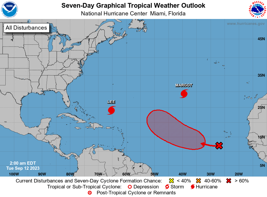
The National Hurricane Center is issuing advisories on Hurricane
Lee, located a few hundred miles north-northwest of the northern
Leeward Islands, and on Hurricane Margot, located over the central
subtropical Atlantic.
1. Eastern and Central Tropical Atlantic (AL97 and AL98):
Two broad areas of low pressure over the eastern tropical Atlantic
are each producing disorganized shower and thunderstorm activity.
These lows are forecast to merge in a couple of days, and the
combined system is likely to become a tropical depression by this
weekend while moving west-northwestward or northwestward at about 15
mph across the central tropical Atlantic.
* Formation chance through 48 hours...low...10 percent.
* Formation chance through 7 days...high...70 percent.
Forecaster Berg