ZCZC MIATWOAT ALL
TTAA00 KNHC DDHHMM
Tropical Weather Outlook
NWS National Hurricane Center Miami FL
200 PM EDT Sat Sep 2 2023
For the North Atlantic...Caribbean Sea and the Gulf of Mexico:
Active Systems:
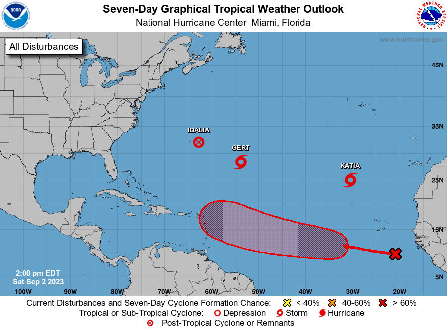
The National Hurricane Center is issuing advisories on Post-Tropical
Cyclone Idalia, located just to the east-southeast of Bermuda, on
Tropical Storm Gert, located about 700 miles east-southeast of
Bermuda, and on Tropical Storm Katia, located about 700 miles
north-northwest of the Cabo Verde Islands.
1. Eastern and Central Tropical Atlantic (AL95):
A tropical wave located over the far eastern tropical Atlantic is
producing disorganized shower and thunderstorm activity to the
south of the Cabo Verde Islands. Environmental conditions appear
conducive for some gradual development of this system by the middle
part of next week, and a tropical depression is likely to form while
it moves westward to west-northwestward at 15 to 20 mph over the
eastern and central portions of the tropical Atlantic.
* Formation chance through 48 hours...low...20 percent.
* Formation chance through 7 days...high...70 percent.
Forecaster Berg