ZCZC MIATWOAT ALL
TTAA00 KNHC DDHHMM
Tropical Weather Outlook
NWS National Hurricane Center Miami FL
200 PM EDT Tue Aug 15 2023
For the North Atlantic...Caribbean Sea and the Gulf of Mexico:
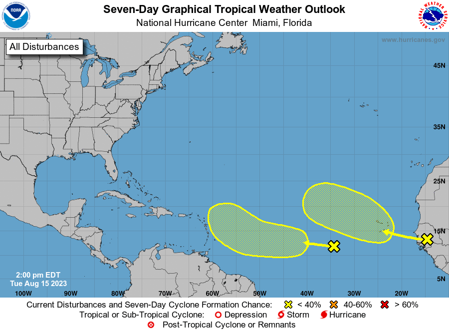
1. Central Tropical Atlantic:
A tropical wave is producing disorganized showers and thunderstorms
a few hundred miles west-southwest of the Cabo Verde Islands.
Development, if any, of this system should be slow to occur while
it moves generally west-northwestward at about 15 mph across the
tropical Atlantic through the end of the week.
* Formation chance through 48 hours...low...near 0 percent.
* Formation chance through 7 days...low...10 percent.
2. Eastern Tropical Atlantic:
A tropical wave is forecast to move off the west coast of Africa
tonight or early Wednesday. Some slow development of this system is
possible later this week or over the weekend while it moves
generally west-northwestward or northwestward across the eastern
Atlantic. Environmental conditions are expected to become
unfavorable for development by early next week.
* Formation chance through 48 hours...low...near 0 percent.
* Formation chance through 7 days...low...30 percent.
Forecaster Pasch