Skip Navigation Links
NOAA NOAA United States Department of Commerce

NHC Graphical Outlook Archive


« Earliest Available         ‹ Earlier         Later ›         Latest Available »
GIS Shapefiles
Central Pacific Eastern Pacific Atlantic

View 2-Day Graphical Tropical Weather Outlook
Click for Eastern Pacific Click for Eastern Pacific

Tropical Weather Outlook Text

ZCZC MIATWOAT ALL
TTAA00 KNHC DDHHMM

Tropical Weather Outlook
NWS National Hurricane Center Miami FL
Issued by the NWS Weather Prediction Center College Park MD
200 PM EDT Tue Aug 1 2023

For the North Atlantic...Caribbean Sea and the Gulf of Mexico:

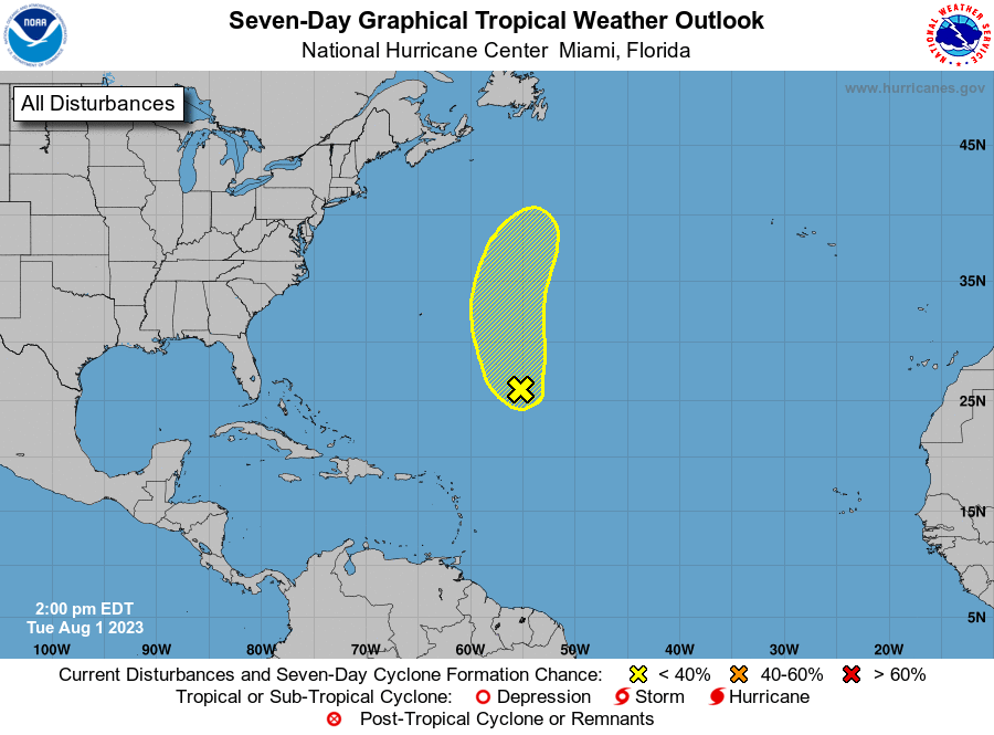
1. Central Subtropical Atlantic (AL96):
Showers and thunderstorms remain disorganized in association with 
a low pressure area located about 800 miles north-northeast of the 
northern Leeward Islands.  Environmental conditions are becoming 
less favorable for tropical cyclone formation, and the low 
is expected to merge with a frontal system over the north 
central Atlantic in about two to three days.
* Formation chance through 48 hours...low...30 percent.
* Formation chance through 7 days...low...30 percent.

Forecaster Beven/Jackson


List of Atlantic Outlooks (May 2023 - Present)
List of East Pacific Outlooks (May 2023 - Present)
List of Central Pacific Outlooks (May 2023 - Present)
List of Atlantic Outlooks (July 2014 - April 2023)
List of East Pacific Outlooks (July 2014 - April 2023)
List of Central Pacific Outlooks (June 2019 - April 2023)
List of Atlantic Outlooks (June 2009 - June 2014)
List of East Pacific Outlooks (June 2009 - June 2014)