ZCZC MIATWOAT ALL
TTAA00 KNHC DDHHMM
Tropical Weather Outlook
NWS National Hurricane Center Miami FL
200 PM EDT Mon Jul 31 2023
For the North Atlantic...Caribbean Sea and the Gulf of Mexico:
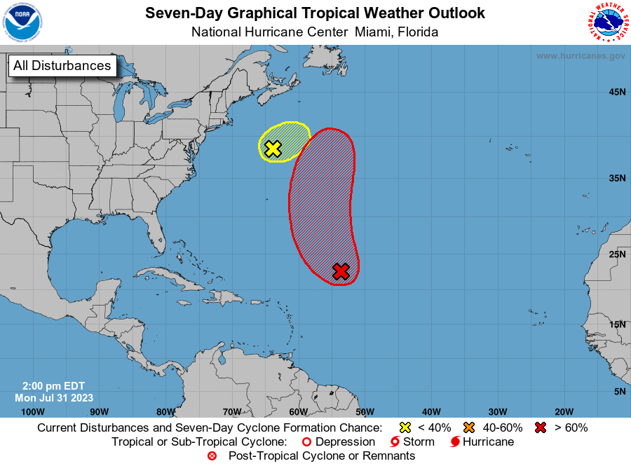
1. Central Tropical Atlantic (AL96):
Showers and thunderstorms associated with an area of low pressure
located about 650 miles northeast of the northern Leeward Islands
have become less organized since last night. However, the system is
producing a small area of gale-force winds well to the east of the
center. Environmental conditions still appear somewhat conducive
for a tropical depression or tropical storm to develop during the
next couple of days while the system moves northwestward and then
northward at 10 to 15 mph over the central subtropical Atlantic.
Additional information on this system, including gale warnings, can
be found in High Seas Forecasts issued by the National Weather
Service.
* Formation chance through 48 hours...medium...60 percent.
* Formation chance through 7 days...high...70 percent.
2. Western Atlantic (AL97):
Shower and thunderstorm activity continues in association a
gale-force low pressure system located over the western Atlantic
several hundred miles south of Nova Scotia. However, recent
satellite data indicate that the low is attached to frontal
boundaries, and it is forecast to move quickly toward the
east-northeast at 30 to 35 mph, reaching colder waters by tonight.
As a result, the likelihood of this system becoming a tropical
storm is diminishing. Additional information on the low, including
gale warnings, can be found in High Seas Forecasts issued by the
National Weather Service.
* Formation chance through 48 hours...low...10 percent.
* Formation chance through 7 days...low...10 percent.
For more information about marine hazards associated with AL96
and AL97, please see High Seas Forecasts issued by the National
Weather Service found under AWIPS header NFDHSFAT1, WMO header
FZNT01 KWBC, and online at
ocean.weather.gov/shtml/NFDHSFAT1.php
Forecaster Berg