ZCZC MIATWOAT ALL
TTAA00 KNHC DDHHMM
Tropical Weather Outlook
NWS National Hurricane Center Miami FL
200 AM EDT Mon Jul 24 2023
For the North Atlantic...Caribbean Sea and the Gulf of Mexico:
Active Systems:
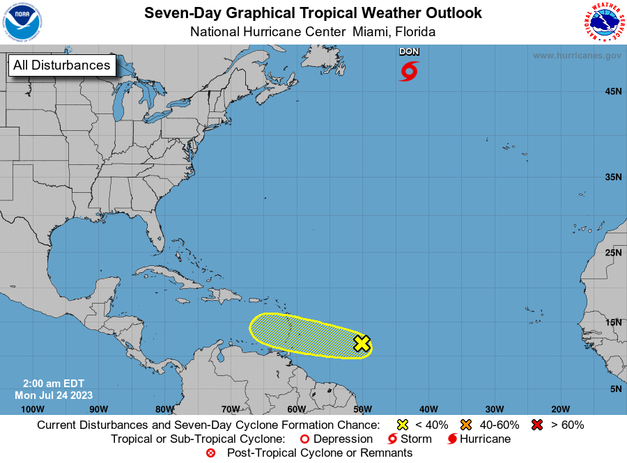
The National Hurricane Center is issuing advisories on Tropical
Storm Don, located over the north-central Atlantic.
1. East of the Windward Islands (AL95):
A weak area of low pressure associated with a tropical wave
continues to produce disorganized showers and thunderstorms about
650 miles east of the Windward Islands. While this system has not
become any better organized recently, some slow development remains
possible during the next couple of days while it moves westward
across the tropical Atlantic and eastern Caribbean Sea.
Environmental conditions are expected to become unfavorable for
development by the middle of the week. Locally heavy rainfall is
possible across the Windward Islands early this week from this
system.
* Formation chance through 48 hours...low...20 percent.
* Formation chance through 7 days...low...20 percent.
Forecaster Blake