ZCZC MIATWOAT ALL
TTAA00 KNHC DDHHMM
Tropical Weather Outlook
NWS National Hurricane Center Miami FL
800 PM EDT Sun Jul 23 2023
For the North Atlantic...Caribbean Sea and the Gulf of Mexico:
Active Systems:
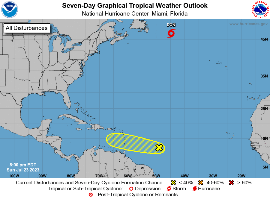
The National Hurricane Center is issuing advisories on Tropical
Storm Don, located over the central Atlantic.
1. Central Tropical Atlantic (AL95):
An area of low pressure associated with a tropical wave continues to
produce disorganized showers and thunderstorms about 700 miles east
of the Windward Islands. Some slow development of this system is
possible during the next couple of days while it moves westward
across the tropical Atlantic and eastern Caribbean Sea.
Environmental conditions are expected to become less conducive for
development by the middle of the week. Interests in the Lesser
Antilles should monitor the progress of this system.
* Formation chance through 48 hours...low...30 percent.
* Formation chance through 7 days...low...30 percent.
Forecaster Cangialosi