ZCZC MIATWOAT ALL
TTAA00 KNHC DDHHMM
Tropical Weather Outlook
NWS National Hurricane Center Miami FL
200 AM EDT Sun Jul 23 2023
For the North Atlantic...Caribbean Sea and the Gulf of Mexico:
Active Systems:
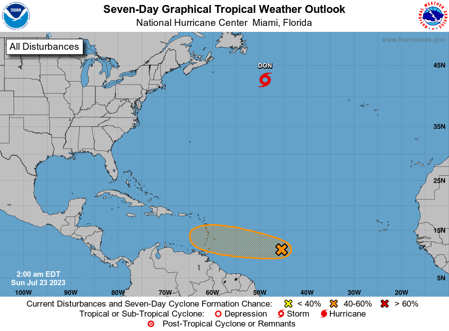
The National Hurricane Center is issuing advisories on Hurricane
Don, located over the central Atlantic.
1. Central Tropical Atlantic (AL95):
Shower activity remains limited in association with a small area of
low pressure located about 1000 miles east of the Windward Islands.
Although environmental conditions are only forecast to be marginally
conducive for some gradual development, this system could still
become a tropical depression during the next few days while it
moves westward across the tropical Atlantic and eastern Caribbean
Sea. Unfavorable upper-level winds are forecast when the system
moves into the central Caribbean around midweek, decreasing the
chances of formation. Interests in the Lesser Antilles should
monitor the progress of this system.
* Formation chance through 48 hours...low...30 percent.
* Formation chance through 7 days...medium...40 percent.
Forecaster Blake