ZCZC MIATWOAT ALL
TTAA00 KNHC DDHHMM
Tropical Weather Outlook
NWS National Hurricane Center Miami FL
800 PM EDT Thu Jul 20 2023
For the North Atlantic...Caribbean Sea and the Gulf of Mexico:
Active Systems:
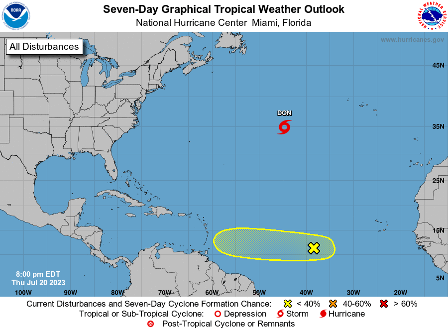
The National Hurricane Center is issuing advisories on Tropical
Storm Don, located over the central Atlantic.
1. Central Tropical Atlantic:
An area of low pressure has formed within the Intertropical
Convergence Zone, located several hundred miles west-southwest of
the Cabo Verde Islands. This system is also interacting with a
tropical wave located farther east, and their combination is
producing an elongated area of showers and thunderstorms over the
eastern and central tropical Atlantic. While environmental
conditions appear only somewhat favorable due to the proximity of
dry air to the north, some slow development of this system is
possible through early next week, as it begins to move westward
across the central tropical Atlantic.
* Formation chance through 48 hours...low...10 percent.
* Formation chance through 7 days...low...30 percent.
Forecaster Papin