ZCZC MIATWOAT ALL
TTAA00 KNHC DDHHMM
Tropical Weather Outlook
NWS National Hurricane Center Miami FL
800 PM EDT Wed Jul 19 2023
For the North Atlantic...Caribbean Sea and the Gulf of Mexico:
Active Systems:
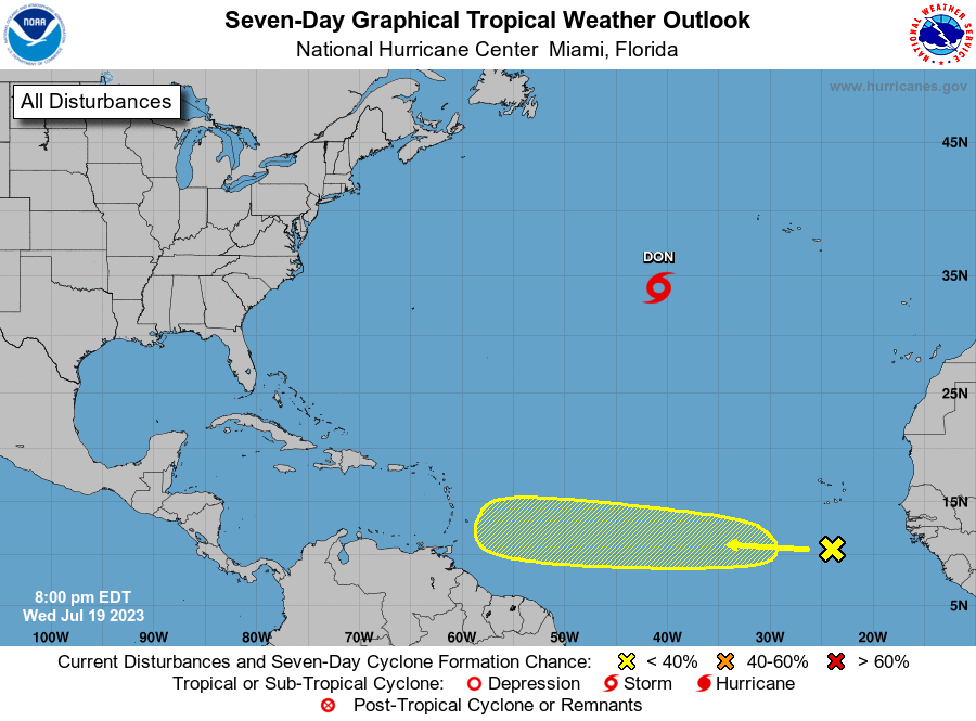
The National Hurricane Center is issuing advisories on Tropical
Storm Don, located over the central Atlantic.
1. Eastern Tropical Atlantic:
A tropical wave located a few hundred miles south of the Cabo Verde
Islands is currently interacting with the Intertropical Convergence
Zone. The combination of these features is producing a broad area of
showers and thunderstorms over the eastern and central tropical
Atlantic. While dry air to the north may prevent significant
organization during the next few days, environmental conditions
could become more conducive for some development by this weekend as
the wave moves westward across the central tropical Atlantic.
* Formation chance through 48 hours...low...near 0 percent.
* Formation chance through 7 days...low...20 percent.
Forecaster Papin