ZCZC MIATWOAT ALL
TTAA00 KNHC DDHHMM
Tropical Weather Outlook
NWS National Hurricane Center Miami FL
200 AM EDT Fri Jul 14 2023
For the North Atlantic...Caribbean Sea and the Gulf of Mexico:
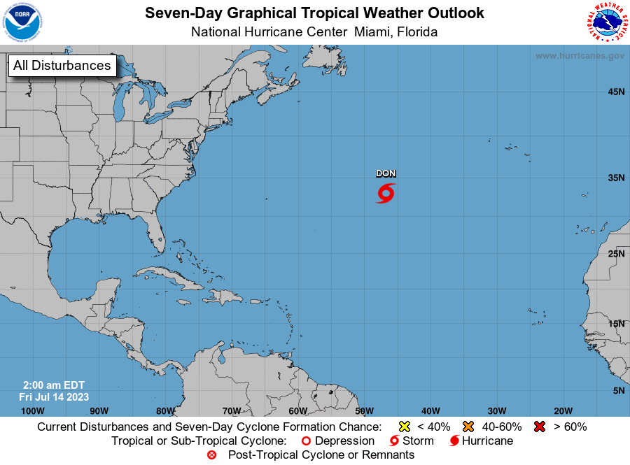
1. Central Atlantic (AL94):
Satellite data indicate that the area of low pressure located about
1000 miles west-southwest of the Azores is producing a large area of
gale-force winds on its east side. In addition, the thunderstorm
activity has remained organized near the center during the past
several hours. If current trends continue, advisories could be
initiated on a subtropical storm later this morning while it
meanders over the central Atlantic. By the weekend, the low should
turn northward, bringing the system over cooler waters and into a
drier airmass potentially limiting further development. Additional
information on this system, including storm warnings, can be found
in High Seas Forecasts, issued by the National Weather Service.
* Formation chance through 48 hours...high...90 percent.
* Formation chance through 7 days...high...90 percent.
High Seas Forecasts issued by the National Weather Service
can be found under AWIPS header NFDHSFAT1, WMO header FZNT01
KWBC, and online at ocean.weather.gov/shtml/NFDHSFAT1.php
Forecaster Cangialosi/Roberts