ZCZC MIATWOAT ALL
TTAA00 KNHC DDHHMM
Tropical Weather Outlook
NWS National Hurricane Center Miami FL
800 PM EDT Thu Jul 13 2023
For the North Atlantic...Caribbean Sea and the Gulf of Mexico:
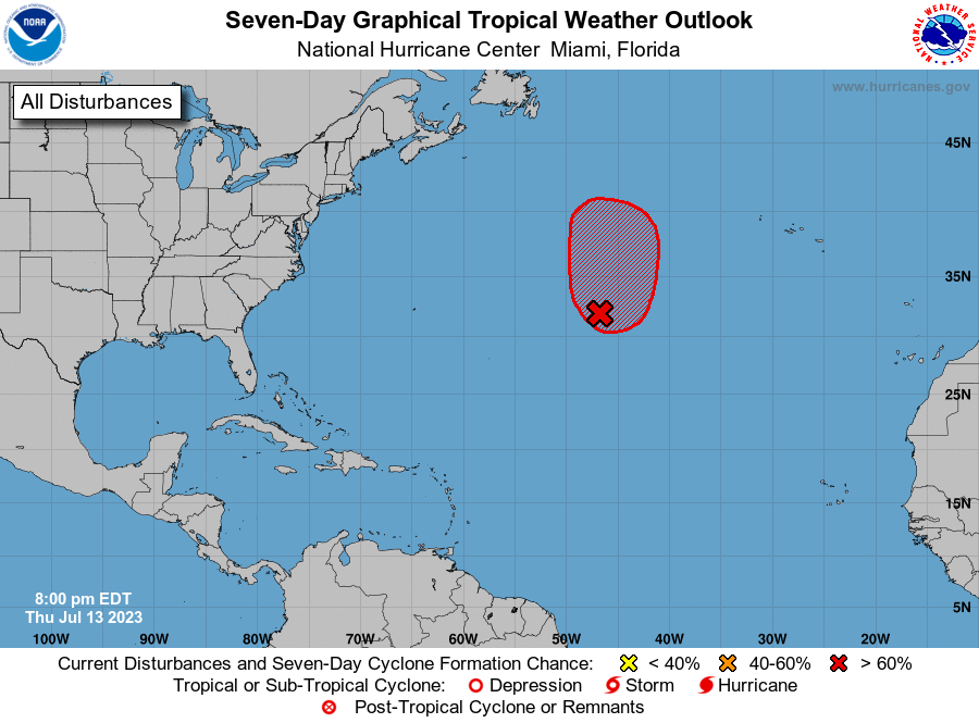
1. Central Atlantic (AL94):
An area of low pressure located about 1000 miles west-southwest of
the Azores has become more organized today, with increased
thunderstorm activity near a better-defined low-level center, along
with gale-force winds. Although the environment is only marginally
conducive, this system will likely become a subtropical storm during
the next day or so as it meanders over the central Atlantic. By the
weekend, the low should turn northward, bringing the system over
cooler waters and potentially limiting further development.
Additional information on this system, including gale warnings, can
be found in High Seas Forecasts, issued by the National Weather
Service.
* Formation chance through 48 hours...high...70 percent.
* Formation chance through 7 days...high...70 percent.
High Seas Forecasts issued by the National Weather Service
can be found under AWIPS header NFDHSFAT1, WMO header FZNT01
KWBC, and online at ocean.weather.gov/shtml/NFDHSFAT1.php
Forecaster Blake