ZCZC MIATWOAT ALL
TTAA00 KNHC DDHHMM
Tropical Weather Outlook
NWS National Hurricane Center Miami FL
200 AM EDT Mon Jul 10 2023
For the North Atlantic...Caribbean Sea and the Gulf of Mexico:
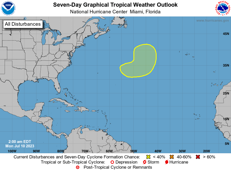
1. Central Atlantic:
An area of low pressure is expected to form in a couple of days
several hundred miles to the east-northeast of Bermuda. This system
is then forecast to interact with an upper-level trough, and could
acquire some subtropical or tropical characteristics during the
middle to latter part of this week while it pivots southeastward to
northeastward. By the weekend, the low is expected to turn northward
bringing the system over cooler waters, likely limiting additional
development.
* Formation chance through 48 hours...low...near 0 percent.
* Formation chance through 7 days...low...30 percent.
Forecaster Papin