ZCZC MIATWOAT ALL
TTAA00 KNHC DDHHMM
Tropical Weather Outlook
NWS National Hurricane Center Miami FL
800 AM EDT Wed Jun 28 2023
For the North Atlantic...Caribbean Sea and the Gulf of Mexico:
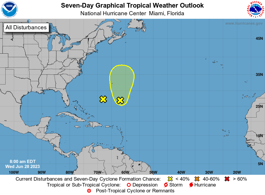
1. South-Southeast of Bermuda:
An area of disturbed weather, associated with a surface trough, has
formed about 400 miles south-southeast of Bermuda. Upper-level
winds are marginally conducive for some slow development of this
system during the next few days while it moves generally northward
at about 5 mph.
* Formation chance through 48 hours...low...10 percent.
* Formation chance through 7 days...low...20 percent.
2. South-Southwest of Bermuda (Remnants of Cindy):
A weak trough of low pressure, associated with the remnants of Cindy
and located about 400 miles south-southwest of Bermuda, is producing
disorganized shower activity. This system is expected to drift
toward the west-northwest during the next couple of days, and
redevelopment is not expected due to strong upper-level winds.
* Formation chance through 48 hours...low...near 0 percent.
* Formation chance through 7 days...low...near 0 percent.
Forecaster Berg