ZCZC MIATWOAT ALL
TTAA00 KNHC DDHHMM
Tropical Weather Outlook
NWS National Hurricane Center Miami FL
800 PM EDT Wed Jun 21 2023
For the North Atlantic...Caribbean Sea and the Gulf of Mexico:
Active Systems:
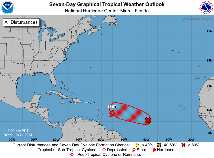
The National Hurricane Center is issuing advisories on Tropical
Storm Bret, located several hundred miles east of the Windward
Islands.
1. Central Tropical Atlantic (AL93):
Showers and thunderstorms continue to show signs of organization in
association with the area of low pressure located about midway
between the west coast of Africa and the Lesser Antilles, and
environmental conditions appear conducive for further development.
Therefore, a tropical depression will likely form during the next
day or so while the system moves westward to west-northwestward at
10 to 15 mph across the central tropical Atlantic through the early
part of the weekend.
* Formation chance through 48 hours...high...80 percent.
* Formation chance through 7 days...high...90 percent.
Forecaster Kelly/Reinhart