ZCZC MIATWOAT ALL
TTAA00 KNHC DDHHMM
Tropical Weather Outlook
NWS National Hurricane Center Miami FL
800 AM EDT Wed Jun 21 2023
For the North Atlantic...Caribbean Sea and the Gulf of Mexico:
Active Systems:
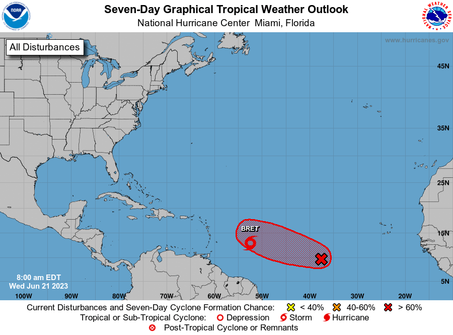
The National Hurricane Center is issuing advisories on Tropical
Storm Bret, located several hundred miles east of the Windward
Islands.
1. Central Tropical Atlantic (AL93):
Satellite images indicate that the broad area of low pressure
located about midway between the west coast of Africa and the
Lesser Antilles has become better organized overnight.
Environmental conditions appear conducive for further development
of this system, and a tropical depression will likely form during
the next couple of days. This system is expected to move westward
to west-northwestward at 10 to 15 mph across the central tropical
Atlantic through the early part of the weekend.
* Formation chance through 48 hours...high...70 percent.
* Formation chance through 7 days...high...80 percent.
Forecaster Roberts