ZCZC MIATWOAT ALL
TTAA00 KNHC DDHHMM
Tropical Weather Outlook
NWS National Hurricane Center Miami FL
200 AM EDT Wed Jun 21 2023
For the North Atlantic...Caribbean Sea and the Gulf of Mexico:
Active Systems:
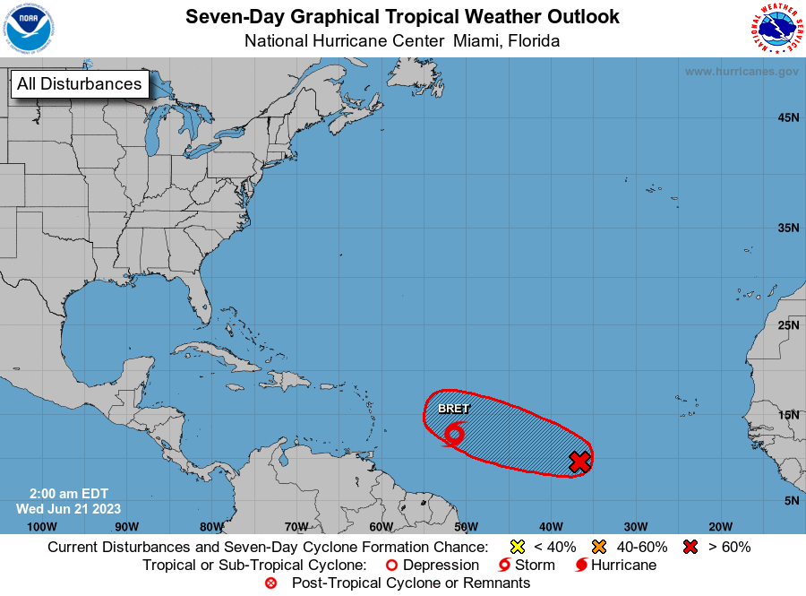
The National Hurricane Center is issuing advisories on Tropical
Storm Bret, located several hundred miles east of the Windward
Islands.
1. Central Tropical Atlantic (AL93):
A tropical wave located several hundred miles west-southwest of the
Cabo Verde Islands is producing a broad area of disorganized showers
and thunderstorms. Environmental conditions appear conducive for
further development of this system, and a tropical depression will
likely form during the next couple of days while the system moves
westward at 10 to 15 mph across the central tropical Atlantic.
* Formation chance through 48 hours...high...70 percent.
* Formation chance through 7 days...high...80 percent.
Forecaster Bucci