ZCZC MIATWOAT ALL
TTAA00 KNHC DDHHMM
Tropical Weather Outlook
NWS National Hurricane Center Miami FL
800 AM EDT Tue Jun 20 2023
For the North Atlantic...Caribbean Sea and the Gulf of Mexico:
Active Systems:
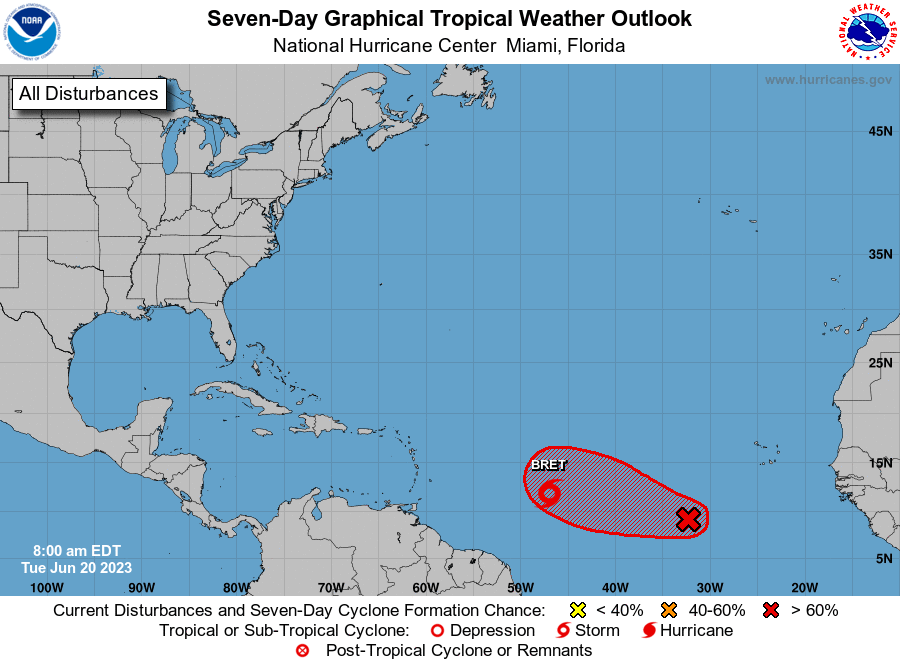
The National Hurricane Center is issuing advisories on Tropical
Storm Bret, located over the central tropical Atlantic.
1. Eastern Tropical Atlantic (AL93):
Showers and thunderstorms are gradually showing signs of
organization in association with a tropical wave located several
hundred miles southwest of the Cabo Verde Islands. Environmental
conditions appear conducive for further development of this system,
and a tropical depression will likely form during the next couple
of days while the system moves westward at 10 to 15 mph across the
eastern and central tropical Atlantic.
* Formation chance through 48 hours...high...70 percent.
* Formation chance through 7 days...high...80 percent.
Public Advisories on Tropical Storm Bret are issued under WMO
header WTNT33 KNHC and under AWIPS header MIATCPAT3.
Forecast/Advisories on Tropical Storm Bret are issued under
WMO header WTNT23 KNHC and under AWIPS header MIATCMAT3.
Forecaster Roberts/Berg