ZCZC MIATWOAT ALL
TTAA00 KNHC DDHHMM
Tropical Weather Outlook
NWS National Hurricane Center Miami FL
800 AM EDT Sun Jun 18 2023
For the North Atlantic...Caribbean Sea and the Gulf of Mexico:
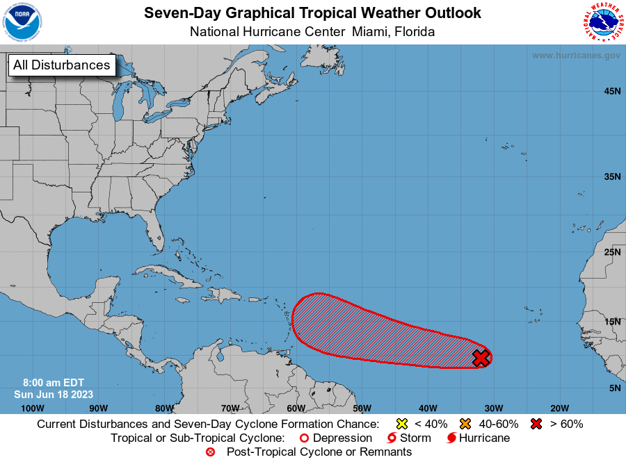
1. Eastern Tropical Atlantic (AL92):
Showers and thunderstorms continue to show signs of organization in
association with a tropical wave located several hundred miles
southwest of the Cabo Verde Islands. Environmental conditions appear
conducive for additional development, and a tropical depression is
likely to form over the next day or two. This system is expected to
move westward at 15 to 20 mph across the eastern and central
tropical Atlantic through the middle part of the week.
* Formation chance through 48 hours...high...80 percent.
* Formation chance through 7 days...high...90 percent.
Forecaster Blake