ZCZC MIATWOAT ALL
TTAA00 KNHC DDHHMM
Tropical Weather Outlook
NWS National Hurricane Center Miami FL
200 PM EDT Wed May 31 2023
For the North Atlantic...Caribbean Sea and the Gulf of Mexico:
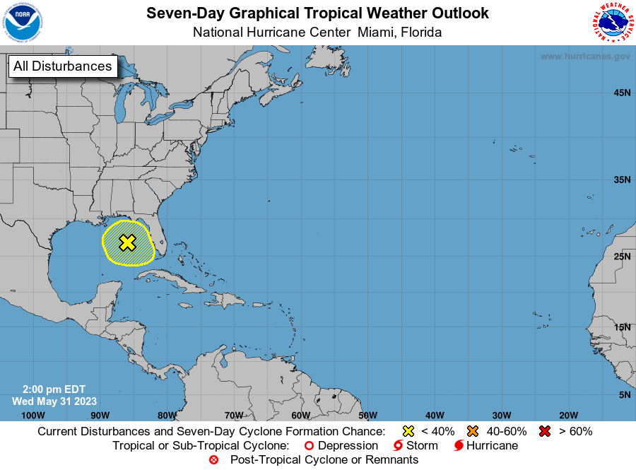
1. Northeastern Gulf of Mexico:
An area of low pressure has formed over the northeastern Gulf of
Mexico in association with disorganized showers and thunderstorms
displaced to its northeast. Environmental conditions appear
marginally favorable for some slow development over the next day or
two as the system meanders over the northeastern Gulf of Mexico.
However, by this weekend environmental conditions are forecast to
become unfavorable for additional development as the system drifts
southeastward towards the Florida Peninsula. Regardless of
development, the system could produce heavy rainfall and gusty winds
over portions of the Florida Peninsula through this weekend.
Additional information on the rainfall and flooding potential can be
found in products issued by your local National Weather Service
forecast office and Excessive Rainfall Outlooks issued by the
Weather Prediction Center.
* Formation chance through 48 hours...low...20 percent.
* Formation chance through 7 days...low...20 percent.
Forecaster Papin