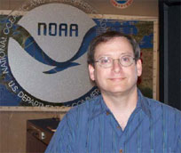
Q & A for NHC - James Franklin
Branch Chief, Hurricane Specialist Unit
 By Dennis Feltgen, NOAA NHC Public Affairs Officer
I grew up in Miami, and I was six years old when Hurricane Cleo (1964) passed over my house. I went out in the eye. There were lots of trees down, which was visually exciting for a six year old. I think that's what got me interested. They were always neat to me after that.
When it comes to hurricane forecasting, what do you see as its greatest challenge?
We have made a lot of progress with track forecasting over the past 20 years. Track errors are now half of what they were 15 years ago. But the intensity errors are still almost exactly what they were 15 years ago. So the big challenge is to try to improve our forecast intensity - particularly rapid intensity change, which we really have very little skill at doing.
Why is that such a problem?
The physical processes that govern track are different from those that govern intensity. Hurricanes move because of very large features in the environment that push them around. The Bermuda High, big fronts, things that are easy to see, easy to measure, easy to model with computers. On the other hand, the things that govern hurricane intensity occur on much smaller scales, the scales of individual thunderstorms for example. Intensity change has to do with the complex physics of what goes on between the ocean and atmosphere. And all of these things are occurring in areas where we have very few measurements. So it's a combination of lack of understanding of how the physical processes work, lack of observations of the small-scale features that are controlling intensity, and to some extent the models are not advanced enough. They don't have high enough resolution to adequately simulate what is going on in the eyewall of a hurricane where the strongest winds are. So there are a lot of issues that must be resolved before we're going to make much progress on this.
What is the greatest misconception on the part of the public about hurricane forecasting?
There was a stretch a few years ago where we had some very notable successes. Isabel (2003) for example was a major hurricane that we had a very accurate bead on in terms of its ultimate landfall point several days in advance, and that was the first year we were issuing five-day forecasts. So I think there might have been some complacency that developed that all of the forecasts were going to be that good. And we ended up with Charley (2004), where the track forecast really wasn't all that far off, yet it surprised a lot of people. People have short memories, and sometimes there is not really an appreciation of the uncertainty in the forecast.
Where do you think we are heading in the next five, ten years in regard to accuracy?
I think that our track accuracy will continue to improve. The computer models are getting better and better at forecasting what's going on in the surrounding atmosphere, so I would expect that as our track accuracy improves, you'll see us looking at things like extending the forecast from five days to seven days, as we did from three days to five days a few years ago. The intensity problem is going to be much harder, but there is a pretty significant effort going on with the Hurricane Forecast Improvement Project (HFIP), which is putting a fair amount of money at the problem. HFIP involves very high-resolution computer models and instrumentation. There will soon be a Doppler radar going on the NOAA Gulfstream-IV jet aircraft, which historically has been used just to improve track forecasts. But now with the Doppler radar we'll start to get some of those key measurements in and around the eyewall in the hurricane core that we have not had before that we can feed into models and try and make some progress on intensity.
You are the first person to occupy a newly-created position at NHC.
We now have a dedicated Hurricane Specialist Unit Branch Chief who will be able to focus his duties on forecast operations. In the past, the Deputy Director served that role, but also had to deal with the programmatic aspects of the Hurricane Center. So, it's an extra body to make sure forecast operations run as smoothly as possible. I'll be able to be a link between the forecaster at the desk who's making the forecast, and our Director or Deputy Director who are trying to convey that information to the public. I'll help out on the floor because there is an awful lot that goes on in hurricane operations that can be pretty overwhelming. So, it's an extra person to oversee that, provide guidance, and provides a second opinion when needed.
What's on your wish list?
One of the things we don't get to do here is look at our mistakes very carefully. Make a forecast, it might be good, it might be bad, it might be completely off the mark, but we rarely have time to analyze and see what went wrong. We have to go on and do the next forecast. In the offseason, you'd think we'd have time to do that, but the offseason is filled with a lot of education, a lot of outreach, a lot of training. If there's one thing I wish we could do here that we don't do is have a dedicated position for that – a person with the resources to go back and look at situations where things did not go quite the way we expected them to go, and really dig into those cases and find out what went wrong.
Send comments to: nhc.public.affairs@noaa.gov
Return to Q & A index of stories


