Text Products
Eastern North Pacific Tropical Weather Discussion
000
AXPZ20 KNHC 130929
TWDEP

Tropical Weather Discussion
NWS National Hurricane Center Miami FL
1005 UTC Fri Nov 13 2026

Tropical Weather Discussion for the eastern Pacific Ocean from
03.4S to 30N, east of 120W including the Gulf of California, and
from the Equator to 30N, between 120W and 140W. The following
information is based on satellite imagery, weather observations,
radar, and meteorological analysis.

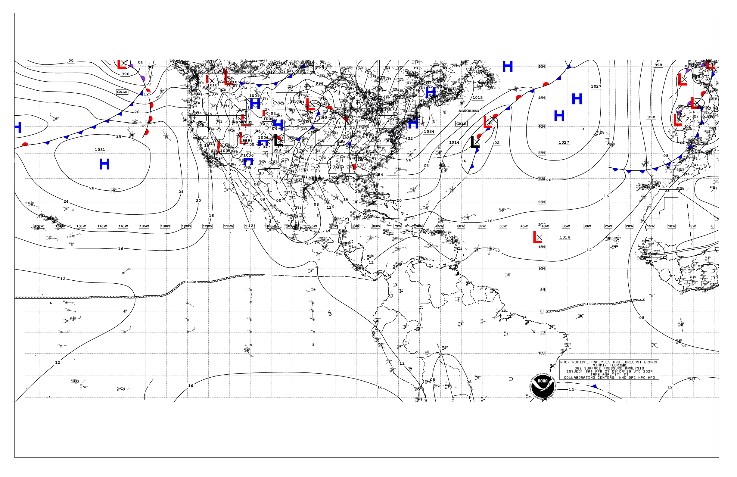
Based on 0600 UTC surface analysis and satellite imagery through
0920 UTC.

...SPECIAL FEATURES...

Significant NW Swell Event: A series of NW swell sets will
continue to impact the waters N of 10N the next several days.
Currently, seas are 12 to 14 ft W of a line from 30N122W to
20N140W, with peak seas around near 29N130W, and wave periods of
13-14 seconds. A reinforcing and larger set of NW swell will
arrive later today, with peak seas around 22 ft near 30N135W by
early this evening. By Sat afternoon, this set with seas of 12
ft or greater will reach across the waters W of 30N118W to
20N132W to 20N140W and peak seas of 22 ft near 30N126W. Those
seas will keep spreading SE, while yet another set with seas of
12 ft or greater arrives to 30N140W by late Sat night, spreading
across the majority of the waters into early next week. Please
read the latest NHC High Seas Forecast at website:
https://www.hurricanes.gov/text/HSFEP2.shtml for more details.

...INTERTROPICAL CONVERGENCE ZONE/MONSOON TROUGH...

The monsoon trough extends from Panama near 07N78W to 06N92W to
07N101W. The ITCZ begins near 06N107W and extends to 03N127W to
04N140W. Scattered moderate to isolated strong convection is
observed from 02S to 06N E of 90W, and from 03S to 16N between
110W and 140W.

...OFFSHORE WATERS WITHIN 250 NM OF MEXICO...

Fresh to strong northerly winds are in the Gulf of Tehuantepec
supported by the pressure gradient between a high pressure system
over southern United States and Mexico, and lower pressure with
the monsoon trough south of the area. Seas in this waters are 5-9
ft. Meanwhile, a weak pressure gradient is present in the
remainder of the Mexican offshore waters with mainly light to
gentle winds and decaying NW swell producing seas of 5-7 ft
across much of the area S of Punta Eugenia, except for slight
seas in the Gulf of California. North of Punta Eugenia, seas are
already rough to 8 ft as a new set of long-period NW swell is
entering the region.

For the forecast, fresh to strong northerly winds and rough seas
around 9 ft will continue through tonight across the Gulf of
Tehuantepec. The next Tehuantepec gap wind event is forecast to
begin by Mon evening and continue through much of the next week.
Winds may reach gale-force starting Tue evening, if not sooner.
Meanwhile, a weakening cold front will move across the offshore
waters of Baja California today, bringing fresh winds and a batch
of rough seas approaching 12 ft. Fresh to locally strong winds
may also briefly impact the northern Gulf of California today.
Then, a larger NW swell arriving Sat will produce high seas to 19
ft. Rough seas will reach all the way to past 100W by early next
week, while additional and reinforcing NW swell sets continue to
arrive.

...OFFSHORE WATERS WITHIN 250 NM OF CENTRAL AMERICA, COLOMBIA,
AND WITHIN 750 NM OF ECUADOR...

The pressure gradient has diminished in the Gulf of Papagayo
region due to a cold front moving across the Gulf of America and
northern Florida. This is resulting in light to gentle winds,
and slight to moderate seas across the Central America offshores.
Otherwise, moderate or weaker SSW winds and moderate seas of 5 to
7 ft are prevalent between the Galapagos Islands and the coast of
Ecuador. Slightly higher winds and seas are possible due to
clusters of moderate to strong convection.

For the forecast, moderate to fresh winds are forecast to return
to the Papagayo region by Sat night, reach strong speeds by Mon
night, and continue through Thu. Moderate N winds may pulse in
the Gulf of Panama early next week. Otherwise, moderate or weaker
winds and moderate seas in merging SW and NW swell will prevail,
except locally rough SSW of the Galapagos Islands through
tonight. Looking ahead, a set of NW swell may build seas to 8 ft
or greater SSW of the Galapagos Islands by the middle of next
week.

...REMAINDER OF THE AREA...

Please refer to the Special Features section above for details on
a series of significant NW swell sets which will impact much of
the open waters.

A weakening cold front continues to move southeastward across
the subtropical waters, extending from 30N120W to 22N130W to
20N140W. The pressure gradient between high pressure centered
well WNW of the area, and the aforementioned front sustains
moderate to fresh NW-N winds behind the front. Old and decaying
NW swell supports seas of 7-9 ft out ahead of the front while 10
to 14 ft seas in long period NW swell are behind the front.
Moderate to fresh NE to E winds and rough seas to 10 ft are found
from 12N to 20 and west of 136W. Merging SW and NW swells
supports combined seas of 7-9 ft across much of the waters S of
10 between 94W and 125W. Elsewhere, winds are moderate or weaker
with moderate seas.

For the forecast, the aforementioned cold front will move across
the northern waters through this morning, bringing with it fresh
to strong winds on either side of the front, and very large seas
in NW swell north of 20N through today. Another cold front will
sweep across the area today into the weekend, bringing even
larger reinforcing NW swell, possibly reaching 24 ft along 30N.
This set of swell with seas of 8 ft or greater will cover the
waters N of 05N and W of 110W by late Sat night, then covering
all of the waters W of 105W. Yet another set of large swell will
arrive Sun, with seas of 8 ft or greater across the entire waters
W of 105W by late Sun night, then across the waters W of 95W by
Tue evening. Meanwhile, the mixed swell over the equatorial
waters will diminish by the weekend. Looking ahead, another cold
front may move into the NW waters by the end of the weekend into
early next week bringing a large area of fresh to strong winds
behind it as high pressure builds in.

$$
Ramos