Text Products
Atlantic Tropical Weather Discussion
000
AXNT20 KNHC 180353
TWDAT

Tropical Weather Discussion
NWS National Hurricane Center Miami FL
0615 UTC Sat Jul 18 2026

Tropical Weather Discussion for North America, Central America
Gulf of America, Caribbean Sea, northern sections of South
America, and Atlantic Ocean to the African coast from the
Equator to 31N. The following information is based on satellite
imagery, weather observations, radar and meteorological analysis.

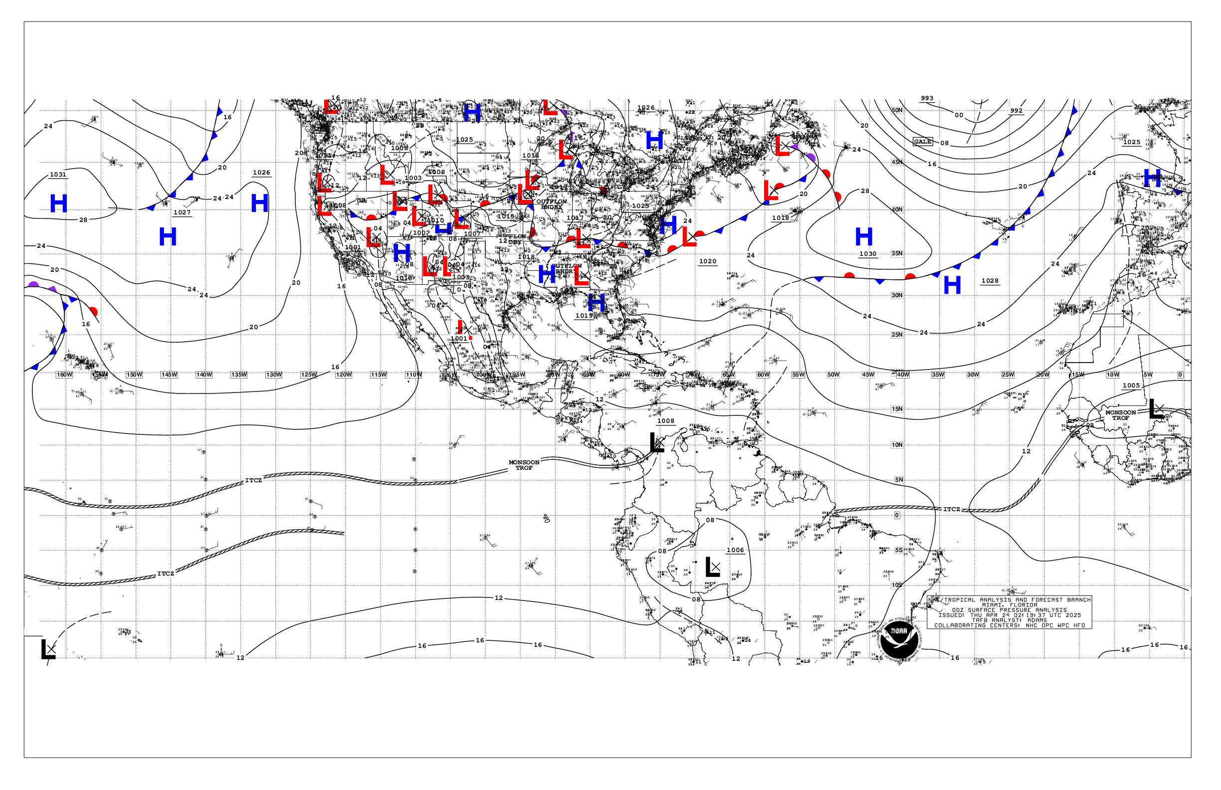
Based on 0000 UTC surface analysis and satellite imagery through
0335 UTC.

...SPECIAL FEATURE...

Caribbean Gale Warning: A tight pressure gradient between the
Atlantic high pressure north of the basin and the Colombian low
will continue to support NE to E winds pulsing to gale-force
across the waters N of Colombia tonight and Sat night. Otherwise,
strong to near-gale force trade winds and rough seas will prevail
across the much of the central Caribbean into early Mon before
contracting to south of 15N. Rough to very rough seas in the 12
to 14 ft range will develop during the times of peak winds.

Please read the latest HIGH SEAS FORECAST
issued by the National Hurricane Center at website -
https://www.nhc.noaa.gov/text/MIAHSFAT2.shtml for more details.

...TROPICAL WAVES...

An eastern Atlantic tropical wave is along 27W, south of 18N,
moving westward at 15 kt. Scattered moderate convection is
observed from 09N to 16N and between 23W and 30W.

A central Atlantic tropical wave is along 49W, south of 17N,
moving westward at 20 kt. A few showers are noted near the trough
axis.

...MONSOON TROUGH/ITCZ...

The monsoon trough enters the Atlantic through the coast of
Mauritania near 21N16W and continues southwestward to a 1012 mb
low pres near 14N24W to 08N42W. The ITCZ extends from 08N42W to
08N48W and then from 08N50W to 08N59W. Scattered moderate
to isolated strong convection is present from 09N to 16N and east
of 20W. Similar convection is found from 08N to 13W and between
51W to 59W.

...GULF OF AMERICA...

Divergence aloft associated with an upper level low, a weak
surface trough and abundant moisture result in strong showers and
isolated thunderstorms over the NE Gulf waters. These storms can
produce gusty winds, frequent lightning and suddenly higher seas.
Mariners should use caution. Meanwhile, diurnal heating and
tropical moisture allowed for thunderstorms to develop over
western Yucatan and progress westward into the eastern Bay of
Campeche, where the activity is currently diminishing.

A 1020 mb high pressure centered south of Louisiana dominates the
basin, supporting moderate to fresh E-SE winds south of a line
from the NE Yucatan to SE Texas. Elsewhere, light to gentle winds
and slight seas prevail.

For the forecast,low pressure across the eastern Gulf will remain
nearly stationary through the weekend then begin to drift
northward early next week, supporting periods of active
thunderstorms in that region. Elsewhere, weak high pressure will
dominate, producing gentle to moderate winds and slight to
moderate seas through the period .

...CARIBBEAN SEA...

A Gale Warning remains in effect for the south-central Caribbean
near the coast of Colombia. Please refer to the Special Features
section for more details.

The 1027 mb subtropical ridge centered near 28N54W in the central
Atlantic forces strong to gale easterly trade winds across the
central Caribbean, with the strongest winds occurring off Colombia
and in the Gulf of Venezuela. A recent scatterometer satellite
pass captured peak winds of 34 kt. Rough to very rough seas are
found in these waters. Moderate to fresh NE-E winds and moderate
seas are present in the eastern Caribbean, Windward Passage and
Gulf of Honduras. Elsewhere, light to gentle winds and slight to
moderate seas are prevalent. No significant convection is evident
across the Caribbean at this time.

For the forecast, the pressure gradient between the Atlantic high
pressure ridge oriented along 27N-28N and the Colombian low will
support NE winds pulsing to gale-force across the waters N of
Colombia tonight and again Sat night. Otherwise, strong to near-
gale force trade winds and rough seas will prevail across the much
of the central Caribbean into early Mon, before contracting to
south of 15N. East winds will pulse fresh to locally strong each
evening this weekend in the Windward Passage.

...ATLANTIC OCEAN...

A weak surface trough in the north-central tropical Atlantic
supports isolated showers north of 26N and between 36W and 44W.
Meanwhile, a broad subtropical ridge centered over the central
Atlantic sustains moderate to fresh easterly winds and seas of 4-8
ft south of 25N and west of 35W. The highest seas are occurring
east of the Windward Islands. In the far eastern Atlantic, fresh
to locally strong N-NE winds and seas of 4-7 ft are noted north
of the monsoon trough and east of 20W. Moderate to fresh SW winds
and seas of 4-7 ft are evident south of the monsoon trough and
east of 30W. Elsewhere, moderate or weaker winds and moderate
seas prevail.

For the forecast west of 55W, the western Atlantic subtropical
ridge extends along 27N-28N tonight, and will gradually weaken
and drift northward this weekend, as a broad surface trough forms
E of 55W. This trough will drift westward next week, reaching
along 65W by Wed. Moderate to fresh trades will prevail S of 24N,
with gentle winds to the N. Pulsing strong winds are expected
during the evenings this weekend N of Hispaniola and in the
Windward Passage.

$$
Delgado