Text Products
Atlantic Tropical Weather Discussion
000
AXNT20 KNHC 271615
TWDAT

Tropical Weather Discussion
NWS National Hurricane Center Miami FL
1815 UTC Tue Oct 27 2026

Tropical Weather Discussion for North America, Central America
Gulf of America, Caribbean Sea, northern sections of South
America, and Atlantic Ocean to the African coast from the
Equator to 31N. The following information is based on satellite
imagery, weather observations, radar and meteorological analysis.

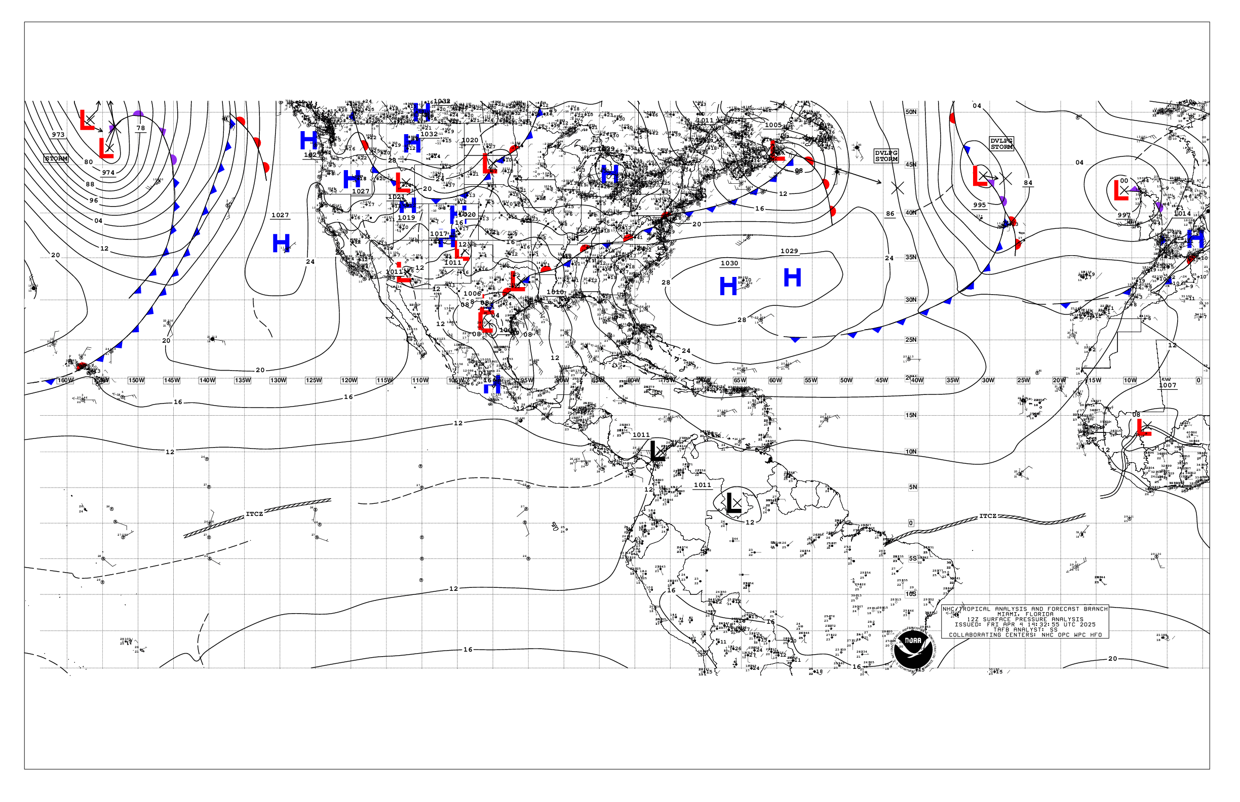
Based on 1200 UTC surface analysis and satellite imagery through
1615 UTC.

...SPECIAL FEATURES...

Gale Warning: A tight pressure gradient between a strong ridge over
the eastern United States and a stationary front extending from
31N60W to a 1008 mb low pres system over the NW Bahamas continues
to support a large area of strong to gale-force NE winds and rough
to very rough seas across the waters north of the front and west
of the low. Scattered to numerous showers and thunderstorms are
associated with these features, more concentrated from 22N to 29N
between 70W and 74W. Abundant tropical moisture will remain in
place in this area, favoring periods of locally heavy rain over
parts of eastern Cuba, Hispaniola and the Bahamas during the next
few days, resulting in localized flooding.

Strong high pressure will remain over the eastern United States
during the next few days. Winds will diminish below gale-force by
this evening. However, fresh to strong winds and rough to very
rough seas in NE swell will persist to the north of the front
through the workweek and into the upcoming weekend, gradually
diminishing. Mariners are urged to remain alert to these dangerous
marine conditions and take the necessary precautions to avoid
these affected areas.

Please, see the latest NWS High Seas Forecast issued by the
National Hurricane Center at website
https:www.nhc.noaa.gov/text/MIAHSFAT2.shtml for further details.

...MONSOON TROUGH/ITCZ...

The monsoon trough reaches the Atlantic through the coast of
Guinea near 11N15W and continues to 10N20W. The ITCZ extends from
10N20W to 09N40W to northern Guyana near 07.5N60W. Scattered
moderate convection is noted from 06N to 10N between 30W and 50W,
and from 08N to 13N between 50W and 60W.

...GULF OF AMERICA...

High pressure over the eastern of the United States extends a
ridge across the Gulf waters promoting fresh to strong NE winds
and seas of 5 to 8 ft across the eastern Gulf waters, including
the Straits of Florida and Yucatan channel. Moderate or weaker
winds and moderate seas prevail elsewhere.

For the forecast, a tight pressure gradient between a strong
ridge over the eastern United States and a complex weather system
over the Bahamas will force fresh to strong NE to E winds and
rough seas over the E Gulf into Thu. Winds and seas will gradually
diminish late this week into the weekend. Elsewhere, gentle to
moderate winds and moderate seas will prevail through the forecast
period.

...CARIBBEAN SEA...

Showers and thunderstorms are currently affecting Hispaniola and
the Caribbean adjacent waters as well as western Venezuela,
including Lake Maracaibo, and northern Colombia. This convective
activity is ahead of an upper-level trough extending from eastern
Cuba to the SW Caribbean. A weak 1010 mb low is analyzed over the
Cayman Islands. Visible satellite imagery indicates a well defined
swirl of low clouds associated with this low. A surface trough
extends from the low center to near 12N82W. Moderate to fresh
northerly winds and seas of 3 to 5 ft are found N of 16N and W of
the low/trough. Higher seas of 6 to 8 ft are occurring in the
Yucatan Channel due to fresh to strong NE winds in the SE Gulf of
America. Elsewhere, mainly moderate E to SE winds and moderate
seas are seen E of 72W while light to gentle winds and slight seas
prevail between 72W and 82W.

For the forecast, the surface trough will gradually weaken through
the middle of the week. Seas up to 8 ft in N to NE swell will continue
to propagate through the Yucatan Channel into this afternoon. Winds
and seas will diminish in the W Caribbean Wed. Otherwise, moderate
to locally fresh trade winds in the E Caribbean will continue over
the next few days, gradually extending westward this week and into
the upcoming weekend.

...ATLANTIC OCEAN...

A Gale Warning is in effect for the SW North Atlantic. Please, see
the Special Features section above for more information.

A stationary front extends from 31N60W to a 1008 mb low pres system
over the NW Bahamas. The pressure gradient between the front and
strong high pressure over the eastern of United States continues
to support a large area of strong to gale-foce winds N of the
low/front. Fresh to strong N winds and moderate to locally rough
seas are occurring between the Bahamas and SE Florida. South of
the front, moderate to fresh southerly winds and rough seas are
evident west of 65W. Farther east, another stationary front is
analyzed and extends from 31N30W to 29N40W to 31N45W. Light to
gentle winds are near the front. Rough seas are found behind this
boundary. The remainder of the Atlantic forecast area is under the
influence of a broad subtropical ridge centered NE of the Azores.
Moderate to locally fresh easterly winds and seas of 4 to 7 ft
are observed south of 22N. Elsewhere, moderate or weaker winds and
moderate seas prevail.

For the forecast west of 55W, the portion of the front east of
62W is expected to move southeastward as a cold front through Thu
while a stationary front will persist over the waters N of 27N and
W of 62W. A high pressure center will remain over the SE United
States during this time. Gale-force winds will diminish by this
evening. However, fresh to strong winds and rough to very rough
seas in NE swell will persist to the north of the front through
the forecast period, gradually diminishing.

$$
GR